Our Trip West
July 6-25, 2008
By Charlotte
Last year I’d chosen where we’d go and what we did on our trip East. This year it was Smoot’s turn to decide for our trip West. He wanted to visit National Parks, especially the ones he’d missed seeing on his last vacation with his family in 1965! We rented a Saturn Vue, a small SUV that luckily was large enough to hold all the stuff I’d gathered for camping and the trip. We left on Sun, July 6.
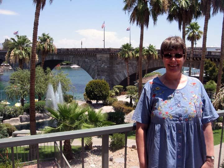
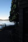
In front of the London Bridge in Lake Havasu City, AZ
Sunday, July 6 Lake Havasu City, AZ and Big Bear Lake, CA
Our first stop was Lake Havasu City, AZ. It’s
claim to fame
is its London Bridge. In 1962 the British government decided to sell
the
outdated bridge over the Thames, built in 1831. It was purchased by the
guy who
founded Lake Havasu City who had it dismantled, each piece number and
then
re-constructed in AZ, the last place you’d expect to find a London
Bridge. Btw,
it’s not the Tower Bridge as some people assume, just a bridge that was
once
over the Thames. We’d wanted to see the
bridge but
hadn’t gotten around to it. It was on the way so we stopped. The day
was
scorching hot, 114 so after a quick photo of me in front of the bridge,
we took
refuge in a restaurant and had lunch.
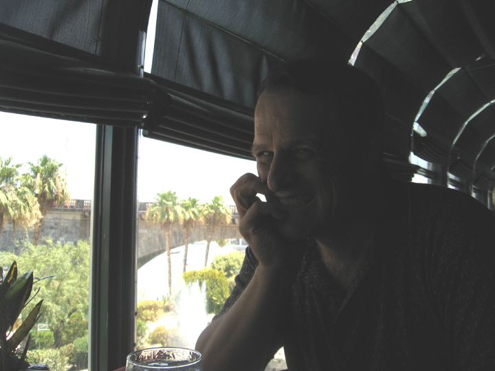
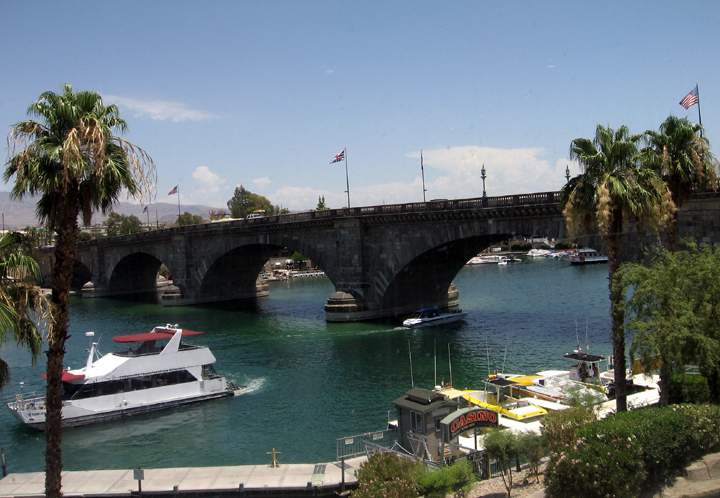
The view of the bridge from the restaurant
window. You can
see the US and British flags.
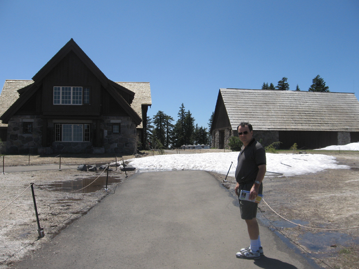
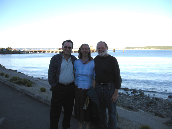
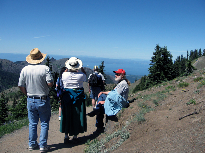
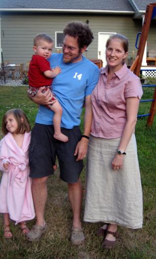
Our next stop was Big Bear Lake, CA, near LA. Smoot’s colleagues, Sandy and Robert Blackwell, had rented a place there and invited us to stop by.
Calvin, Smoot, Sandy and Bob Rabideau, one of the Blackwell’s employees, at the cabin at Big Bear Lake, CA
That night Smoot got out his telescope and we had a viewing party. Sandy and Robert invited us to spend the night with them. They were leaving the next morning so we’d both be leaving at the same time.
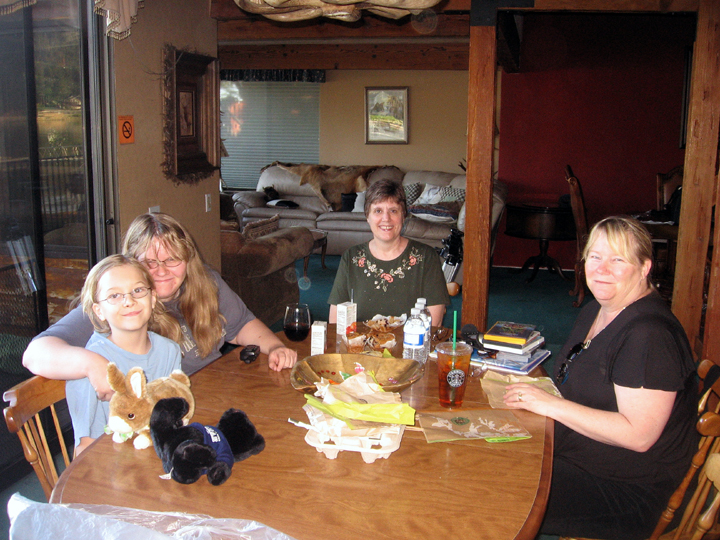
Calvin, Kelly, Charlotte and Sandy. We treated them to a Starbucks breakfast before we all left.
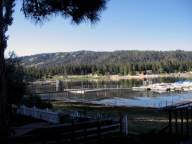
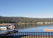
A somewhat lopsided panorama of Bear Lake.
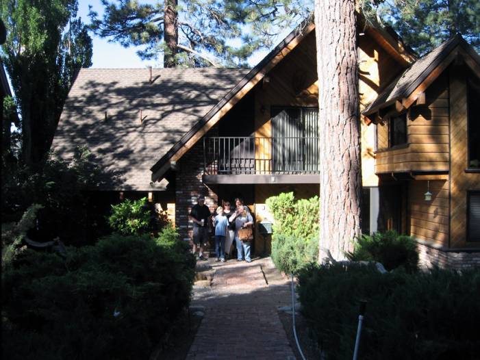
The Blackwell group in front of the rented house at Big Bear Lake
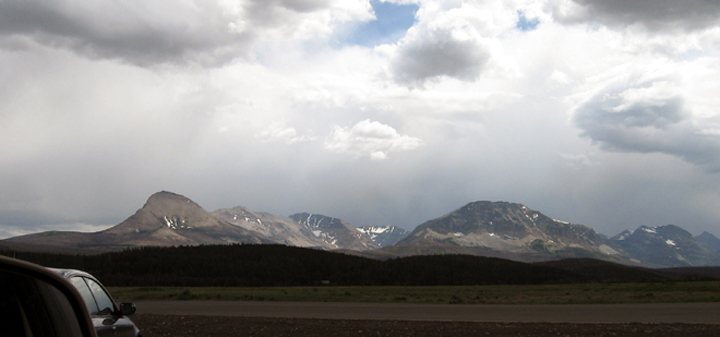
Monday, July 7 Big Bear Lake, CA and Sequoia National Park, CA
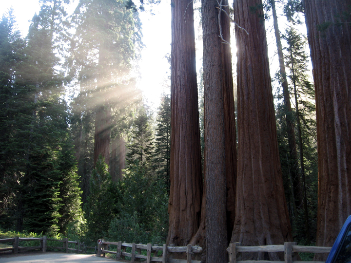
Next we drove to Sequoia and Kings Canyon National
Parks. Sequoia was established in 1890 as
the second U.S. national
park, after Yellowstone. The park is 404,051 acres, south of and contiguous with Kings Canyon
National Park
and the two are administered by the National Park Service as one
unit. The park is most famous for its
Giant Sequoias, including
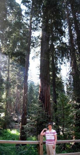
the General Sherman, the largest tree on Earth in terms of wood volume.
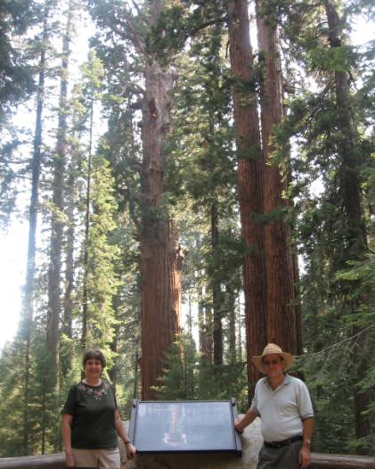
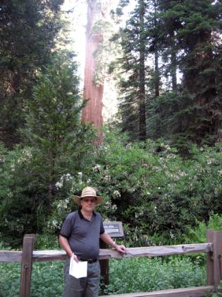
Photo of us in front of most of the giant
sequoia named
General Sherman.
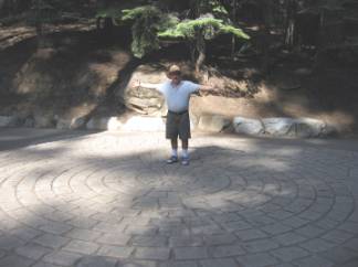
Photos of us standing in the middle of a brick outline of the circumference of General Sherman. It’s 102.6 feet around at the ground level and its volume is over 52,500 cubic feet.
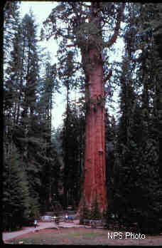
Above, a National Park Service photo of the giant sequoia, General Sherman. The little white dots at the base are people!
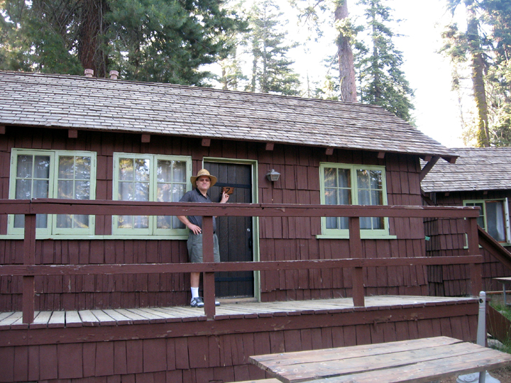
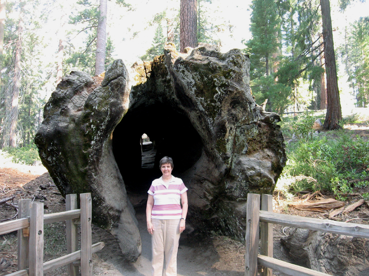
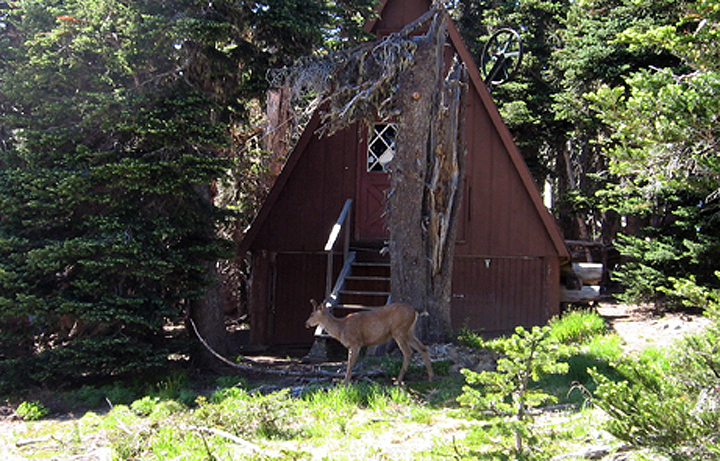
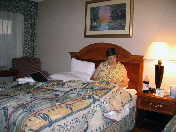
We stayed in a cabin in Sequoia Park, lucky number 7.
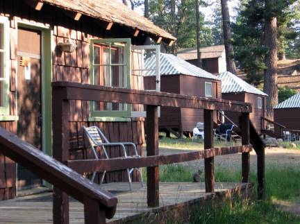
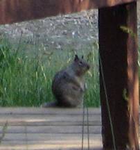
Another view of our cabin with a close-up of a park squirrel. We were told repeatedly not to feed the wildlife, to keep them wild.
We were tired from a long day, had supper at the restaurant in the park and crashed. The night was cooler than I expected, foreshadowing what was to come. I should have pulled out our own blankets!
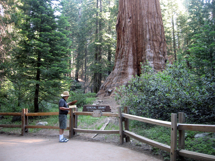
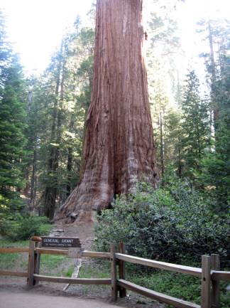
Tues, July 8 Kings Canyon and Yosemite National Parks, CA
We got up early and drove to Kings Canyon National Park's Grant Grove, home of the
General Grant and
other giant sequoias.
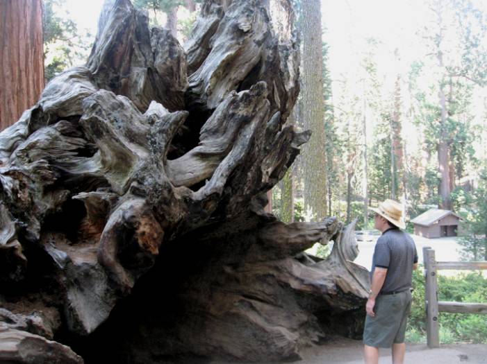
Smoot in front of General Grant. It was too big
to get in a
single shot so I had to take two.
Referred to as the Nation's Christmas Tree, the General Grant is the third largest sequoia at 267 feet tall, and at 107 feet in circumference near the base, it is the thickest sequoia in the world. It is estimated to be between 1,500 and 2,000 years old.
Me in front of one end of the Fallen Monarch.
The Fallen Monarch is the remnant shell of a giant sequoia. In the 19th century it was used as a U.S. Cavalry stable for 32 horses and as a saloon.
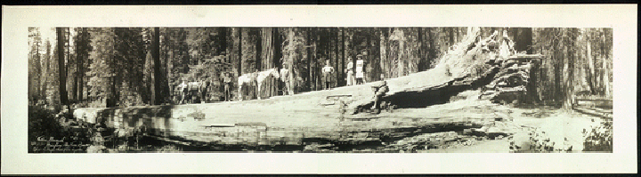
This is a photo from the Library of Congress showing the tree in 1911, the year my mother was born. You can tell the scale by the horses standing on it.
Smoot at the other end of the Fallen Monarch.
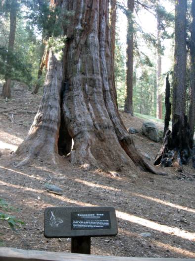
In the past, individual trees were named for
states. This
is the Tennessee Tree showing burn damage.
A closer photo of Gen Grant with Smoot looking
at a cone.
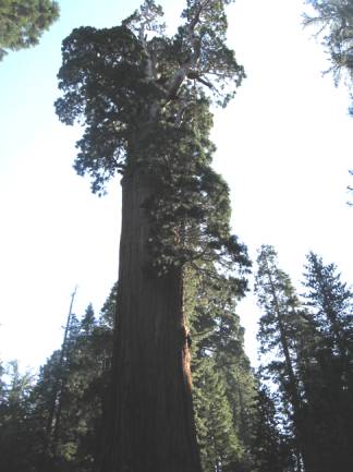
Another two part photo of General Grant.
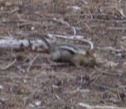
Another park critter, a chipmunk
A photo of the Pennsylvania Tree, in honor of my Taylor and Ramsey ancestors who lived in that state. I can see why so many Californians are called ‘tree huggers’. They have so many huge and beautiful ones!
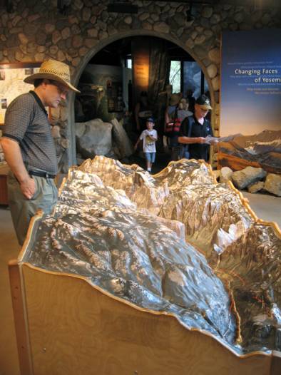
Smoot looking at a scale model of Yosemite.
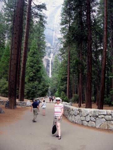
After Sequoia and Kings Canyon, we drove to Yosemite. The park covers an area of 761,266 acres or 1,189 square miles and reaches across the western slopes of the Sierra Nevada mountain chain. Designated a World Heritage Site in 1984, Yosemite is internationally recognized for its spectacular granite cliffs, waterfalls, clear streams, Giant Sequoia groves, and biological diversity. Yosemite was a focal point in the development of the national park idea, It’s roughly the size of Rhode Island. We watched a film on the park and then went wandering. It was hot, but the free bus system helped us get around. Just as at all the parks we visited there were big signs saying don’t feed the wildlife and you’re warned to bus your outdoor tables at restaurants, there were still birds and squirrels who darted among the people eating outside, grabbing stray crumbs and french frys!
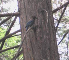
On the way to the Yosemite Falls we saw a blue-ish bird that was probably a Stellar Blue Jay,
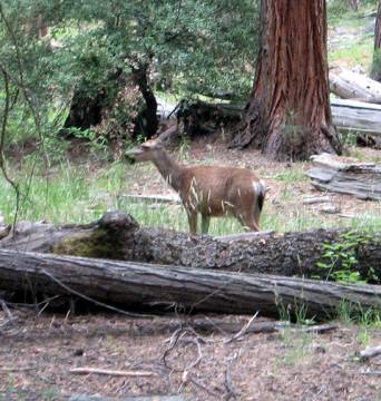
a deer, that got lots of attention,
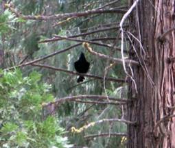
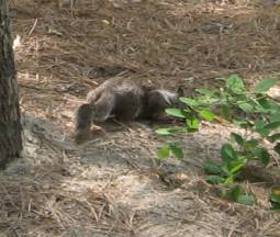
A black bird and another squirrel. Once again we were told not to approach, bother or feed the wildlife or remove anything from the park..
On the way out of the Park we decided to check to see if any campsites were available. There was one at Tuolenene Meadows. We set up our tent and had supper. We’d gotten some chopped beef, tomatoes and onions at a grocery store. Smoot cooked them together and boiled some corn. It was quite tasty, even if the meat was a bit chewy.
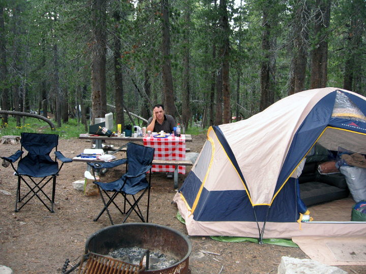
Smoot looking pooped after setting up the tent, campsite and cooking!
We had to put all our food in a special bear-proof metal box at our site. The bears have figured out how to rip open not only tents looking for food, but cars too!
The
special bear-proof metal
box is on the left, under the cooler. This photo is deceiving. Smoot is
in shorts, but that night it got very cold.
We hadn’t realized how cold it was going to get, down to 45 degrees. For us AZ folk, that’s cold! I hadn’t packed clothes for that kind of weather and because of that, we were both very cold and slept restlessly that night. We were glad we’d brought along the portable toilet so we didn’t have to walk down to the restrooms! During the night we heard what I thought was a baby crying, but it was probably a bobcat. We got up at first light, got in the car to use the heater to warm us up, but the car never heated up. We decided we’d be warmer if we went on and took down our tent and got on the road.
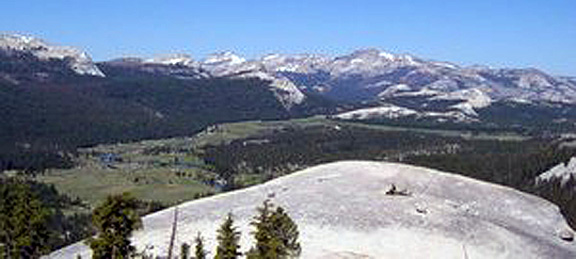
A photo of Toulemne Meadow from Lambert Dome in Yosemite from the NPS website
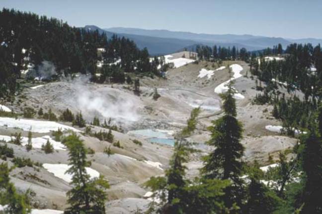
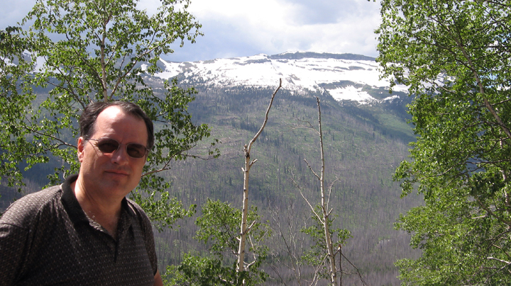
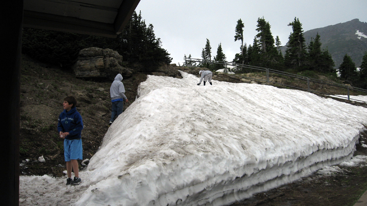
Wed, July 9 Lassen Volcanic Park, CA
Another place Smoot and his family hadn’t had time to see back in 1965 was the Lassen Volcanic Park so we decided to go there. I’d never even heard of it, but shivering from the cold of Yosemite and wearing several layers of clothes we stopped for breakfast at a little diner outside Yosemite then made our way to Lassen. At many of the parks we visited there was road construction going on, making us wait from just a few moments up to 20 minutes until we could drive down the road. While waiting to be able to drive down the single lane open in Lassen I took a photo of a big pile of snow next to our car. It seemed strange going from 114 in AZ to snow in CA!
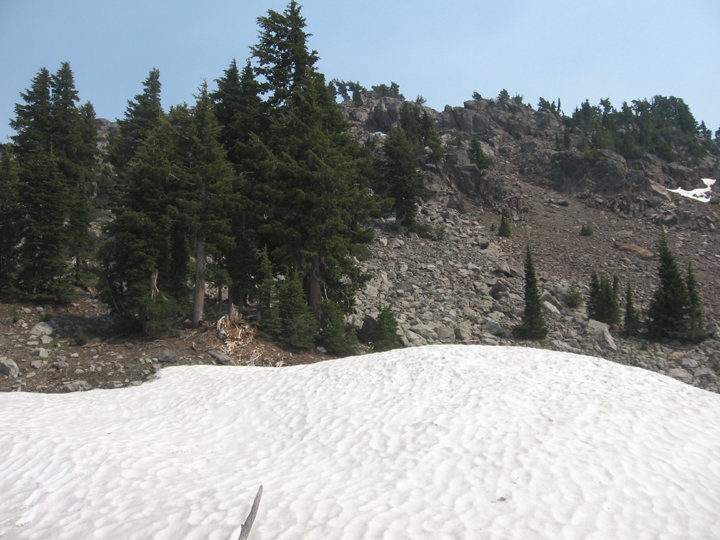
A pile of snow in Lassen Volcanic Park
Photos of Lassen from the web
We drove from Lassen Park to Redding, CA, expecting it to be easy to get a room without a reservation. No so! Because of the terrible fires in the area, the Best Western we first checked was full. They explained that all the hotels and motels were filling up with evacuees and fire fighters. The Red Lion had an open room so we took it. The sky was hazy with the smoke from the fires.
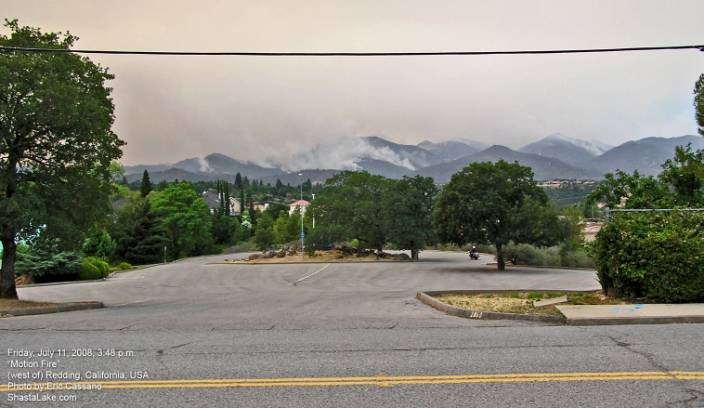
A photo from ShastaLake.com of the Shasta-Trinity fires burning around Redding, CA around the time we were there.
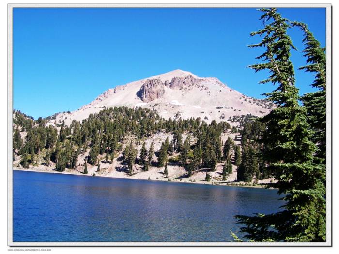
Thurs,
July 10 Crater Lake National Park,
CA
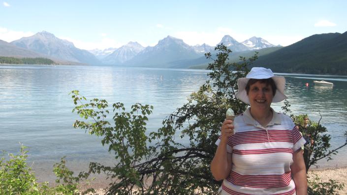
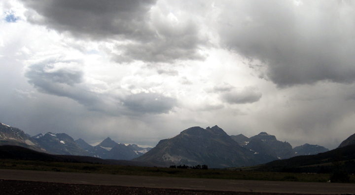
The next morning we went to Crater Lake.
It’s famous for having such clear, intensely blue water and it did! The
reason for the intense blue color is that the water is so clear that
light can reflect from so deep that the other colors of the spectrum
are absorbed so the only thing left is blue.
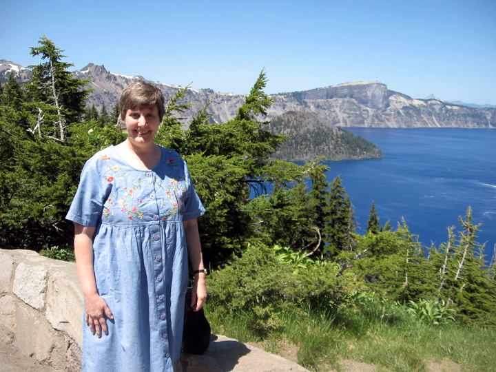
Me standing by Crater Lake
Smoot walking up to a big pile of snow blocking the path at Crater Lake
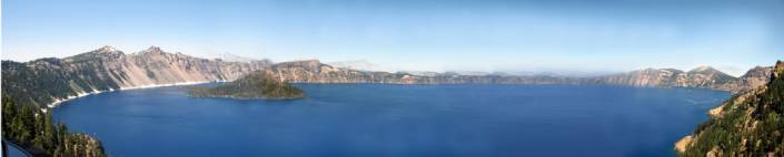
A panorama of Crater Lake
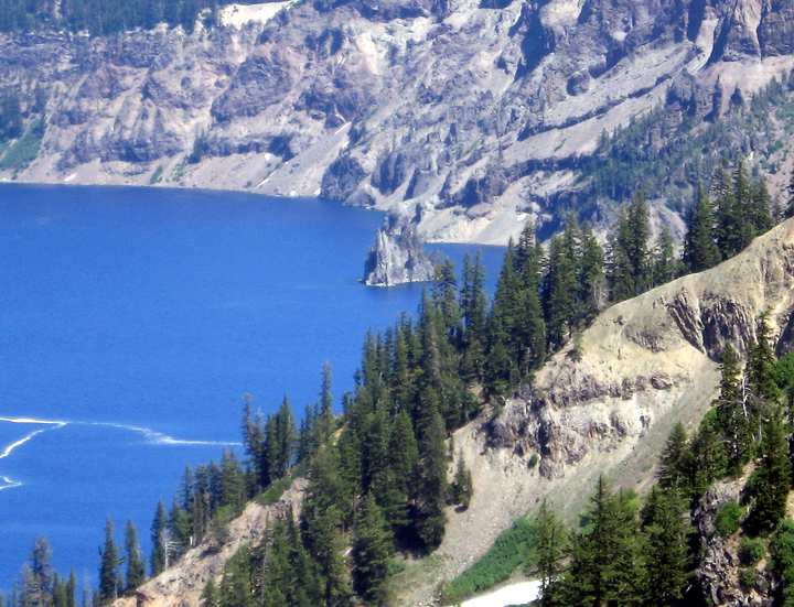
A rock formation called the Phantom Ship in Crater Lake
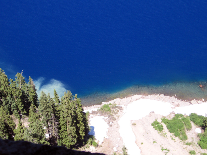
Looking straight down at the lake from the Sinnott viewing area
After Crater Lake, we drove to and spent the night in Eugene, Oregon.
Fri,
July 11 Mount St. Helens National
Monument and Port Townsend, WA
Next we went to Mount St. Helens, It was amazing how much destruction was still evident from the 1980 eruption. (We were in England visiting friends when the volcano erupted. Smoot’s aunt and uncle, who lived in Chelan were safe, but got ashfall from the event.)
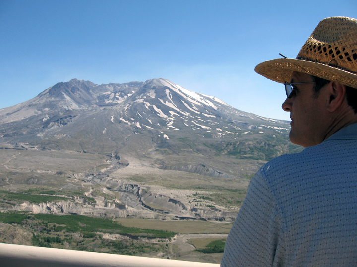
Smoot gazing at Mount St. Helens in Washington
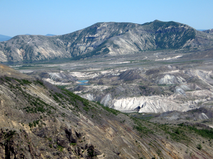
One of the many lakes formed by the eruption in the middle of what looks like a moonscape
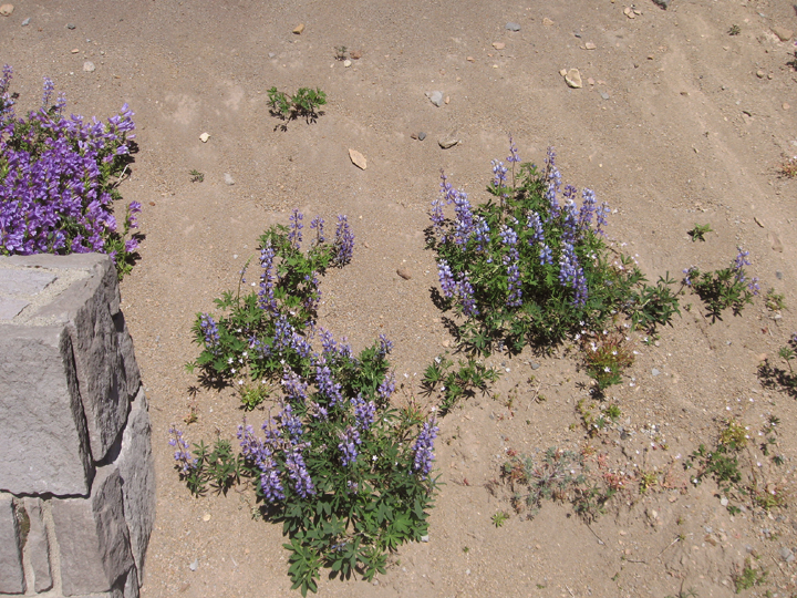
I was surprised to see flowers that looked like Bluebonnets. They’re in the same family and because they fix nitrogen in the soil, they helped revitalize it for other plants to come back and grow.
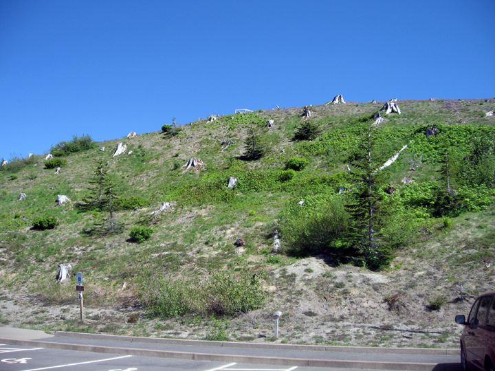
Some grass, flowers and trees had started growing back, but you could still see the stumps of trees blasted by the volcano.
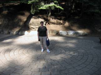
Richard and Connie, our choir friends, were going to be at their vacation house in Port Townsend, WA during our trip so we arranged our schedule so we could visit with them before they drove back to AZ.
We drove from Mount St. Helens to Port Townsend, and after some confusion caused by our GPS saying a street went through when it didn’t, we found their house and went out to eat at one of their favorite restaurants on Puget Sound.
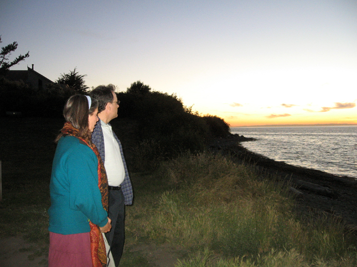
After supper we drove down to the beach near their property. It was chilly, but the sunset was beautiful.

Richard had to take a call!
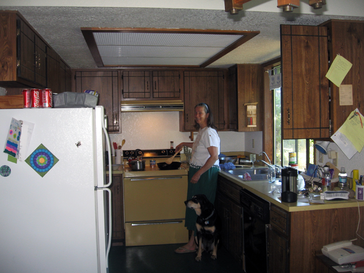
Connie hard at work making breakfast.
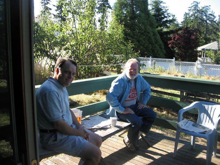
Smoot and Richard lounging on their back deck. They have apple, plum and pear trees on their property.
Sat, July 12 Port Townsend, and Olympic National Park,WA with Connie and Richard
Smoot
wanted to see Olympic Park, something Connie and Richard hadn’t yet
done so we
packed up. The dogs weren’t happy we were leaving them!
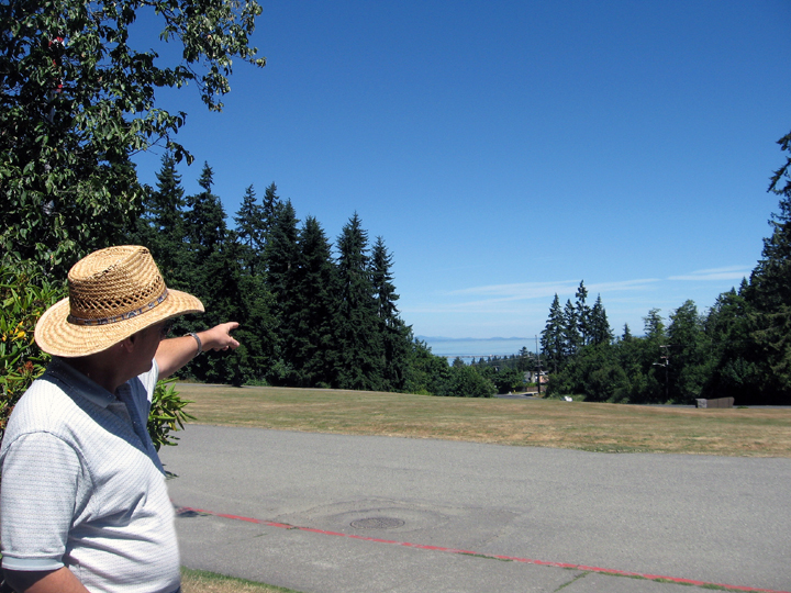
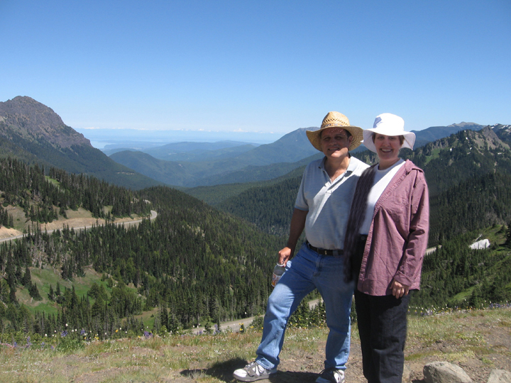
We went to the Visitor’s Center first. Smoot pointed out Vancouver Island off in the distance. It was a beautiful, clear day.
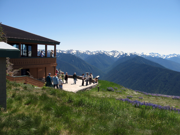
Connie, Richard and Smoot walking down to view the Olympic Mountains
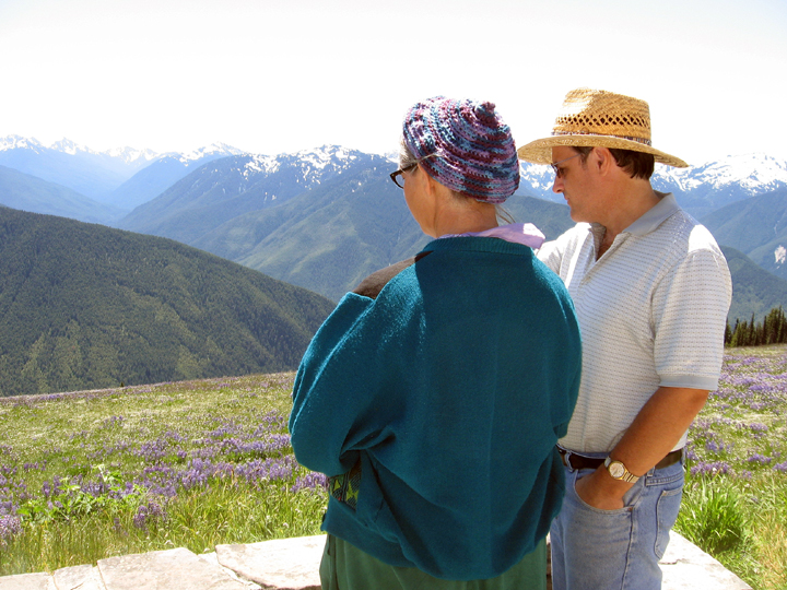
We walked up a steep trail that had amazing views of the park. (Connie crocheted the cute hat she’s wearing while we were there!)
Looking at the San Juan Straits.
A deer wanders by one of the emergency snow shelters
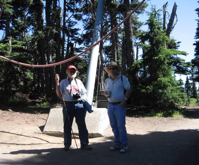
Richard and Smoot at the base of a ski lift.
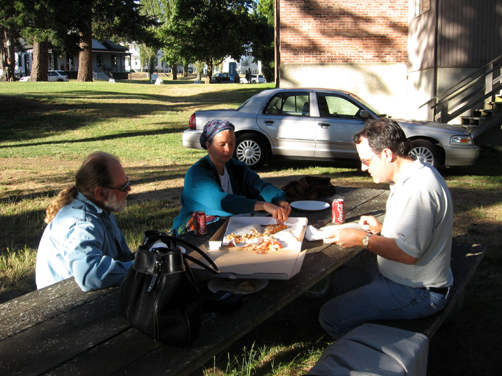
After our visit to the park we decided to forego a picnic on the beach but instead have pizza from their favorite place and then attend a dobro concert at Fort Worden, a military base that had been closed and now used for community activities. We found a handy picnic table near the auditorium to eat.
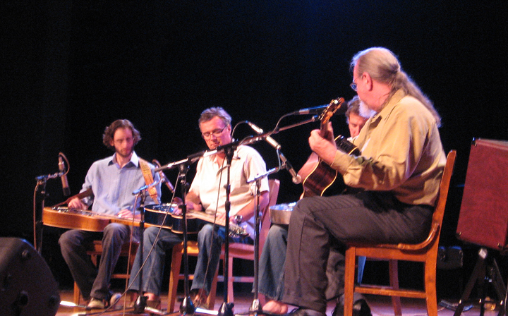
The concert was the culmination of a workshop on the steel guitar instrument. At the end, all the performers played together.
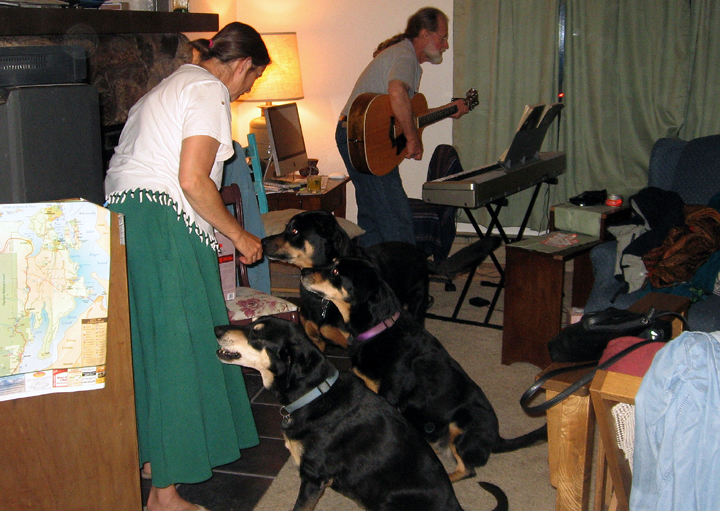
Before Connie and Richard played their own concert, the dogs were given some treats so I could get all of them in one photo!
Richard, Connie and Smoot made music
Sun,
July 13 Port Townsend, Lacey
and Mount Ranier National Park, WA
Smoot’s
cousin, Marti and nephew, Theron had arranged for a mini family reunion
in
Lacey for Sunday so we packed up the car to leave. Richard helped!
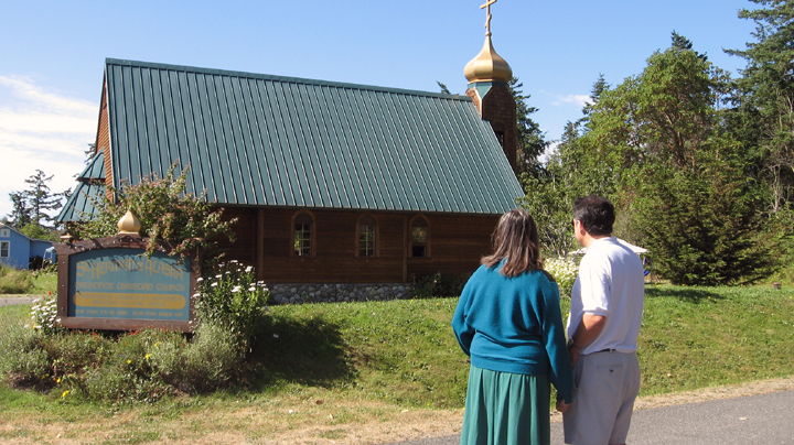
Before
we left, Connie and Richard wanted to show us the lovely little Greek
Orthodox
church near them. While we were looking at it, a man in black came out.
It
turned out it was one of the priests who invited us in to join the
service and
see the icons painted on the wall. We thanked him but said we were in a
hurry.
As we walked away, a woman and her daughter drove up, carrying a big
salad. We
asked if she were a member of the church and she said she was. She
spoke very
eloquently about what a wonderful community it was. There is a UU
church in
Port Townsend too. Had we had time, we might have attended its service.
We drove to Lacey, Washington for the reunion. Smoot remembered May Louise’s retirement home from his visit in Jan 1999.
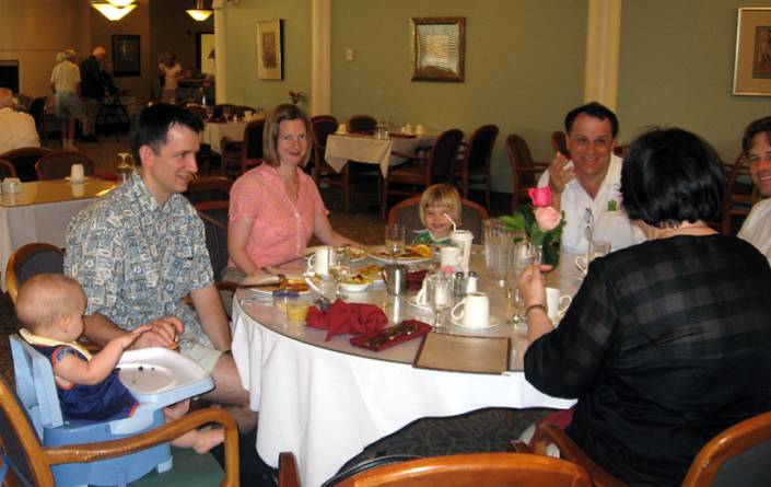
Around the table from left, Natalie, nephew Theron, Monika and Kiera Stanford, Smoot, a sliver of Matt and the back of Marti. We had not yet gotten a chance to meet our Stanford great nieces. We now have five great nieces!
<>
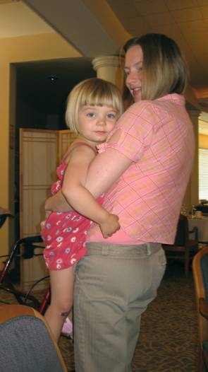
It took several tries to get Kiera to look at my camera, but Natalie was more cooperative!
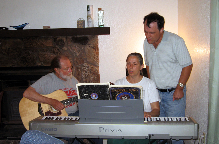
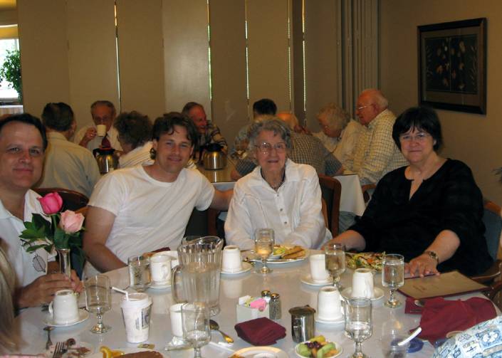
Marti’s son, Matt is going to start working in Seattle, where Theron and Monika live. He was in town so that group came over for the visit, but had to leave. Smoot, Marti, May Louise and I then went to her apartment for more visiting and to look at photos.
We had a wonderful time
chatting and laughing and hearing May Louise’s racy stories but we had
to get
on to our next destination, Mount Ranier National
Park.
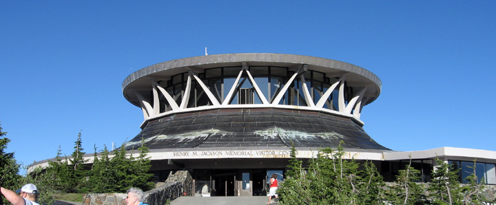
The
very strange and soon to be replaced Visitor’s Center at Mount Ranier.
We
thought it looked like a flying saucer!
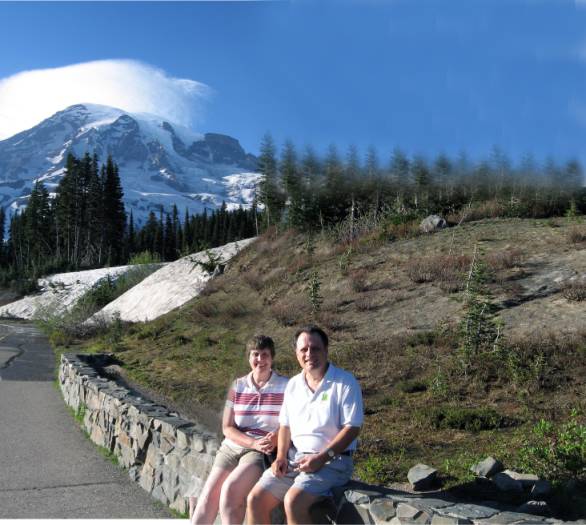
In
front of Mt. Ranier
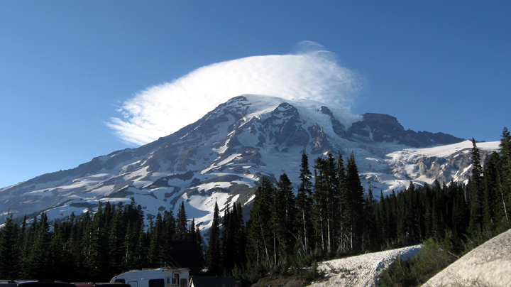
A
cloud looking like a beret on top of Mt Ranier
We
spent the night in Yakima, WA.
Mon,
July 14 Nez Perce National Historical Park, Spalding, ID and camping at
Heyburn State
Park on Lake Coeur d’Alene, ID
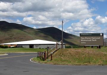
We
decided to drop by a NPS park near Lewiston, Idaho, the Nez Perce
National
Historical Park. It turned out to be very interesting, with well done
displays
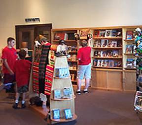
and helpful, friendly staff. I hadn’t bought anything yet on the trip.
I was
attracted to some small blankets that were for sale there and bought
one.
The
photos are from the NPS website.
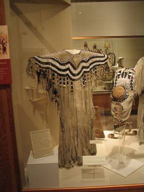
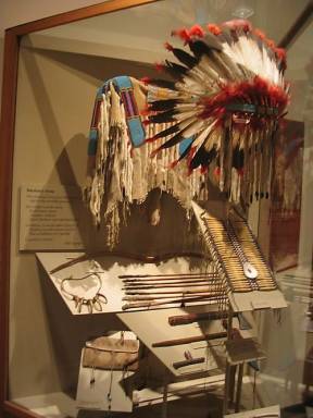
The
museum in the Nez Perce visitor’s center had a beautiful display of
artifacts.
We
were on our way to visit Smoot’s niece, Emily and her husband Chris in
Libby,
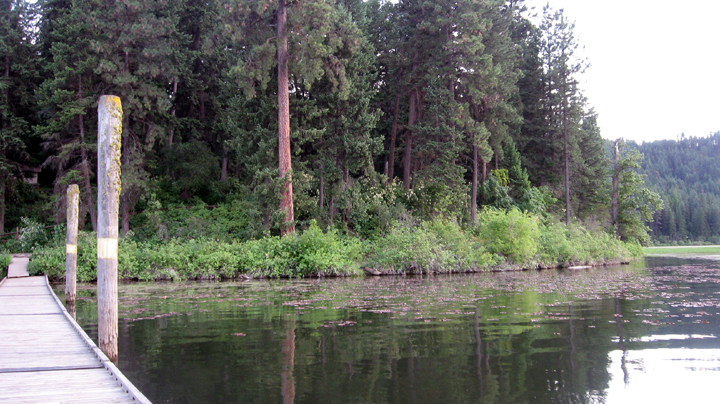
Montana. We decided to camp out again and found a nice place, Heyburn
State
Park on Lake Coeur d’Alene, Idaho.
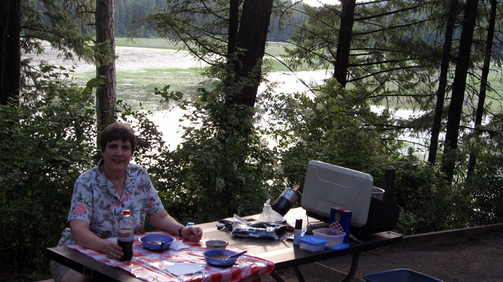
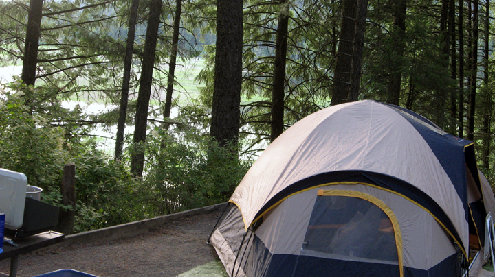
We
decided to take a stroll around the park, to enjoy the pretty views. It
cost
$12.72 to camp; Smoot didn’t have change so put $13 in the box!
Tues,
July 15 Libby, MT
We
packed up the car again and made our way toward Libby, Montana. Smoot
noticed
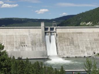
that a dam seemed to be the main attraction in the area so we stopped.
It was
run by the Army Corps of Engineers and had some interesting displays in
the
visitor’s center, but they seemed a bit defensive about their purpose.
The
display stressed the four things they have to balance, power
generation, flood
control, recreation, and conservation.
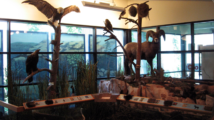
A display at Libby Dam about the wildlife in the area. They also had an Eagle Cam that was focused on a nest with two baby eagles and their mom. The link to the Eagle Cam is http://www.nws.usace.army.mil/PublicMenu/Menu.cfm?sitename=libby&pagename=eagle_cam_main. The Libby Dam Visitor Center is located eighteen miles northeast of Libby, Montana on US Highway 37.
Photos
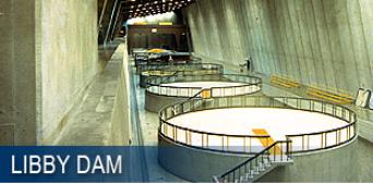
of Libby Dam from the Army Corps of Engineers website
We
hadn’t been able to reach Emily or Chris by phone to tell them we were
in town,
but left a message. We’d tried to find their address but hadn’t been
able to.
I’d picked up a brochure on things to do in Libby, which included a
list of
motels. We didn’t want to choose one until we’d gotten a recommendation
so went
to a McDonald’s to wait for a call. I said I thought they had WiFi,
which they
did, but before we could figure out whether it was worth it to pay for
it,
Chris called. He was helping out a friend by babysitting but
recommended a
motel. He asked if we’d seen the dam and when we told him we had, he
said that
was about it to see in Libby! We decided to try to make it back to the
dam for
a tour. We’d missed it during our earlier visit. I called to see if I
could
reserve a place in the tour but was told they had to see ID so we flew
down the
highway, getting very frustrated with the slow and inconsiderate
drivers on the
road, but made it in time for the tour. Having had a tour of Hoover
Dam, we
knew what to expect, but it was still interesting. We weren’t allowed
to take
pictures or even to take cameras or purses with us. We got a motel
room, that
included a full size kitchen and settled down to wait for Emily to
call. WE got
together with her for supper during which she was checking her cell
phone
because as a physician she was on call, After supper we drove by her
clinic
then drove over to where Chris was baby sitting and visited until their
friend,
a fellow physician, came back.
Left,
Chris and Emily with their friends’ kids. The girl was named Harper and
had
been born around the same time as our great niece, Harper Mitchell.
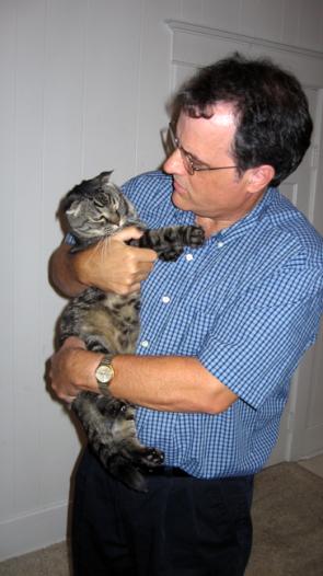
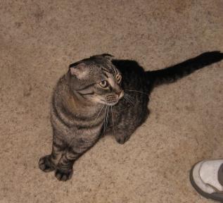
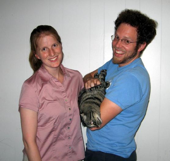
Right,
Smoot with Cosmo, Emily and Chris’ Scottish Fold cat. We went back to
their
apartment that turned out to be above a yet-to-open Mexican restaurant.
No
wonder we hadn’t been able to find it! We had a fun visit and enjoyed
hearing
about Chris’ research grant and the work he’s doing on electric power
generation. Smoot saw some parallels to computer networking so they had
a lot
to talk about. Cosmo seemed interested too!
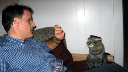
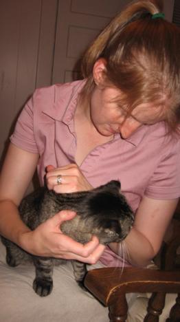
Smoot
expounding while Cosmo and Chris listen!
Cosmo’s
Scottish Fold ears show well in these photos
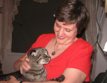
Emily,
Chris and their ‘baby’ Cosmo!
Wed,
July 16 Glacier National
Park, MT
After
a restful night’s sleep, we were on the road again but before we left
Libby, I
wanted to take pictures of Emily’s clinic and the view from her office
which is
to the left of the entryway. A nice view to have every day! Then it was
on to
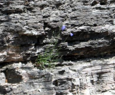
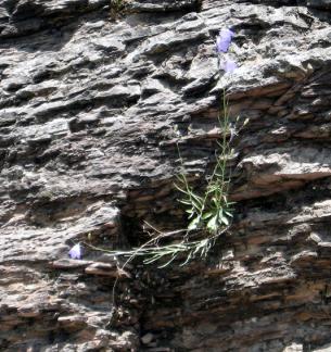
Glacier National Park.
Me
at Glacier National Park. After a short stop in the very commercialized
village, we started off to drive on the famous Highway to the Sun.
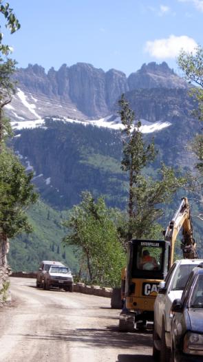
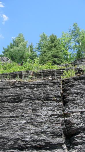
Once
again we were stopped for construction on the road. That gave us time
to get
out and take this picture of flowers growing out of the rock
and
one of the glacier topped peaks.
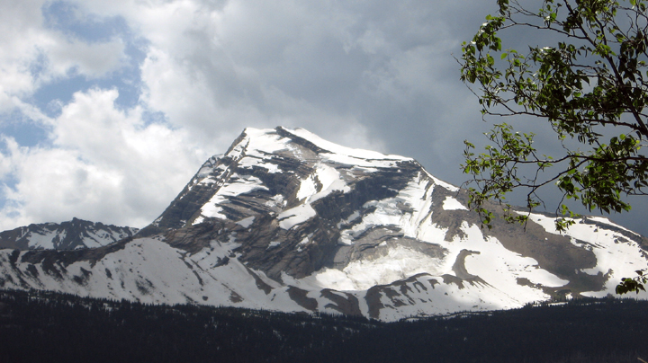
Many
of the glaciers have shrunk, probably due to global warming. It’s
possible they
might disappear all together, which would be a tragedy.
We
stopped at the visitor’s center and saw kids playing on the packed
snow. They
were throwing snowballs at each other, which was okay, but when they
started
throwing them at strangers, their parents finally intervened.
As
we were driving away from the Glacier National Park visitor’s center a
storm
blew up that dropped the temp and made driving on the narrow
mountainous road
even more scary.
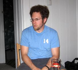
After
we left Glacier National Park we spent the night in Great Falls,
Montana. Smoot
had changed a setting on my camera and was trying to change it back. To
test
it, he took this photo of me. You’ll notice my computer on one side of
me and
my diet Dr Pepper on the other!
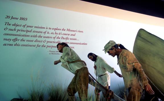
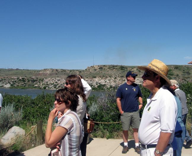
Thurs,
July 17 Lewis & Clark Historic Interpretive Center in Great Falls,
MT and
Butte, MT
Photos
from the center’s website
We’d
looked at things to do in Great Falls and saw the Lewis and Clark
Center, run
by the National Forest Service. Just as with the Nez Perce center, it
turned
out to be fascinating and well worth our time to stop by.
Except
for the tower across the Missouri River, this is what Lewis and Clark
would
have seen when they got near the falls they knew they’d have to portage
around.
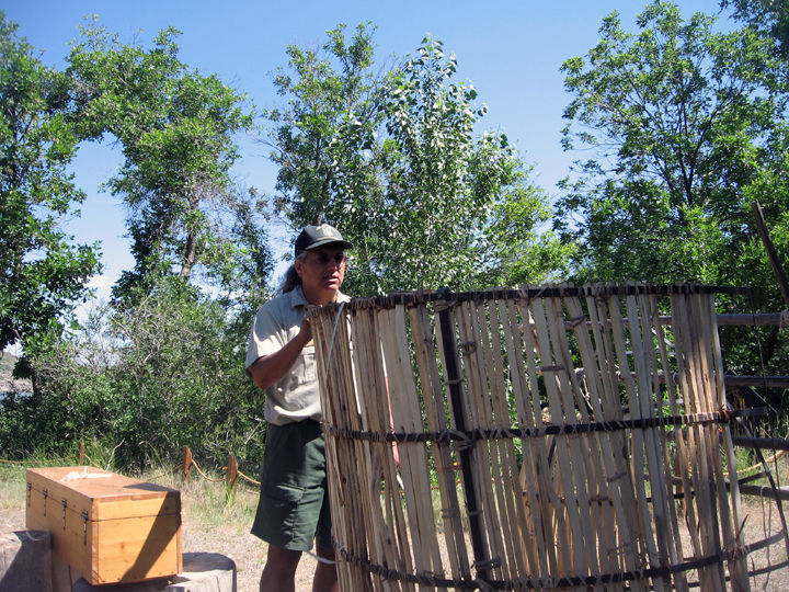
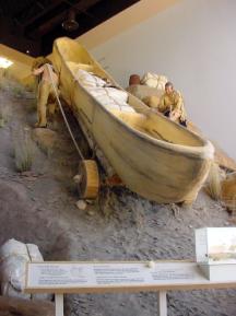
We
heard a talk on the metal boat Lewis and Clark brought with them. They
thought
they’d have access to pine pitch to make it water tight, but there
weren’t any
pines on the prairie. They tried something else, but it didn’t work.
The ranger
above is putting the boat together in the way they think L & C would have done it.
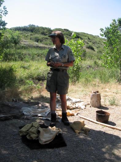
We
heard another talk about how they would have tanned leather for their
clothes.
At
Chris’ recommendation we stopped at the visitor’s center in Butte and
learned a
bit about the history of mining in the area. We spent the night in
Bozeman,
Montana.