Our Trip West, part 2
July 6-25, 2008
By Charlotte
Fri,
July 18 Yellowstone and
Grand Tetons National Parks, MT and WY; Two Oceans Lake
We
had been to Yellowstone back in 1980 and were surprised at how much
more
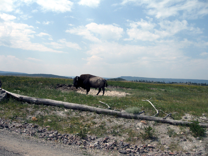
developed it was and crowded. It’s obviously a popular place. On the
way in we
saw an iconic buffalo, more correctly, a bison and other critters.
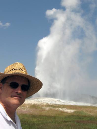
And,
of course, we had to see Old Faithful again. The park brochure said the
geyser
had changed because of natural forces, but also vandalism, a sad
comment on our
society.
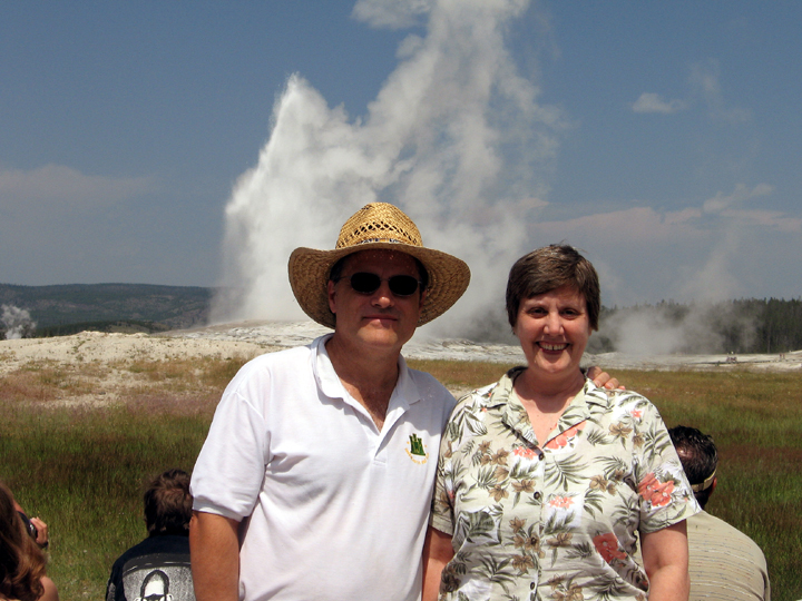
We’d
offered to take a photo of a family as Old Faithful
blew; they then took one of us.
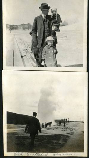
I
remembered seeing photos from a visit to Yellowstone that my
grandparents took
in 1915. At that time you could walk or ride right up to the geyser.
(My mother
is the little girl standing in front of my grandfather.) Thankfully,
the rules
are more strict now, but there is still a wooden boardwalk near the
geyser as
in the photo above.
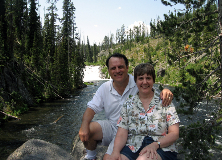
As
we were driving through the park we stopped at Lewis Falls. Again, we
offered
to take a photo for some people so they took one of us.
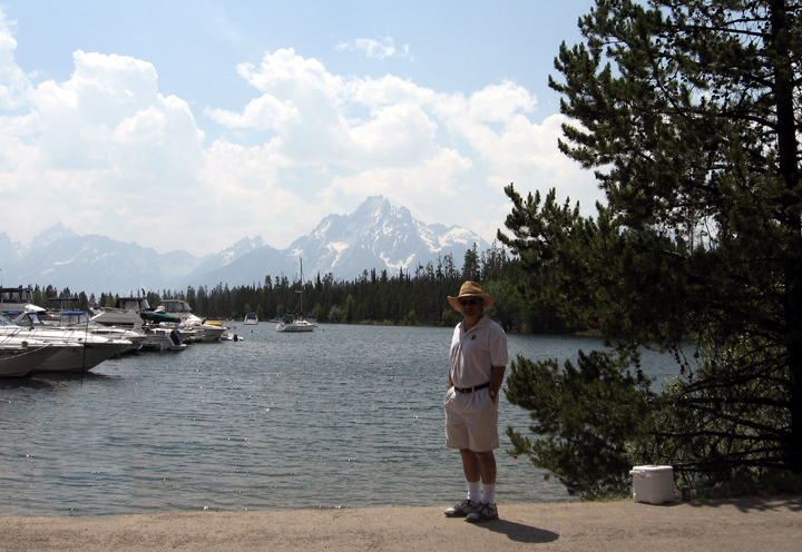
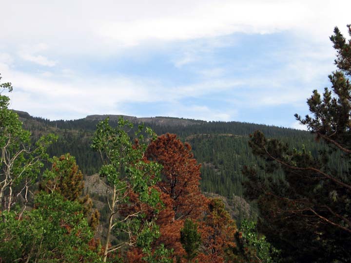
Grand
Tetons National Park is south of Yellowstone. Here is Smoot with the
beautiful
mountains in the background.
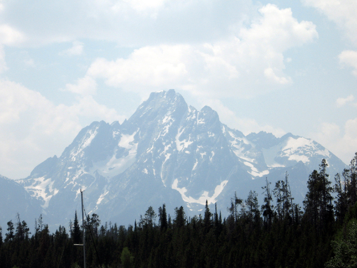
A
closer view
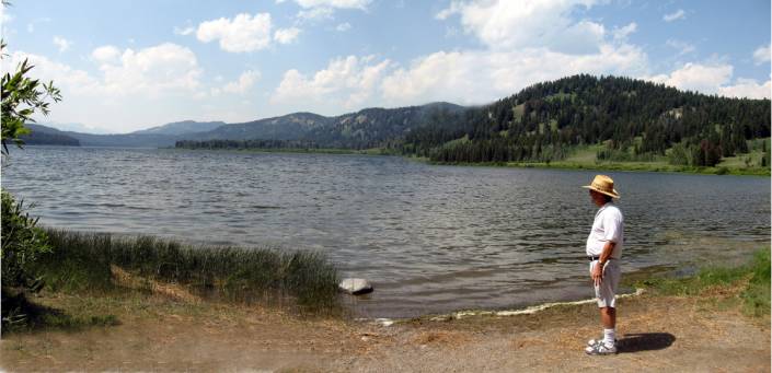
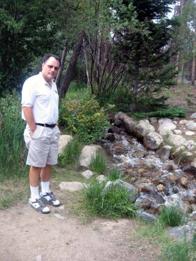
One
of the places Smoot wanted to see was Two Oceans Lake. The plateau it’s
on
drains to both the Missouri and the Columbia watersheds which means its
waters
could end up in the Atlantic or the Pacific.
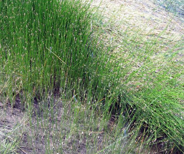
They’re
a little hard to see in the photo, but while we were there we were
surrounded
by lots of bright blue dragonflies. I’d never seen such colorful ones
before.
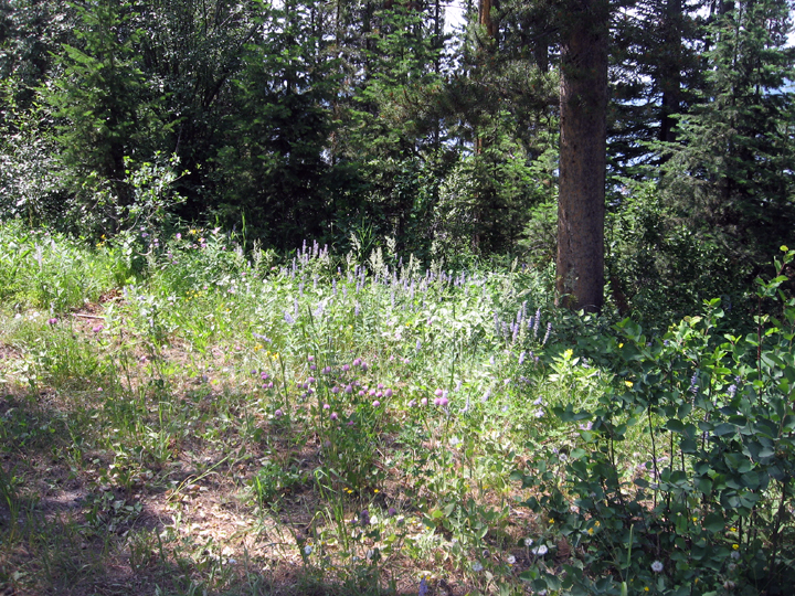
Colorful
flowers at Two Oceans Lake. We spent
the night in Riverton, WY.
Sat,
July 19 Devil's Tower
National Monument, WY
The
next day we went to see Devil’s Tower, the first national monument in
the
nation and where the aliens landed in the movie, “Close Encounters of
the Third
Kind!”
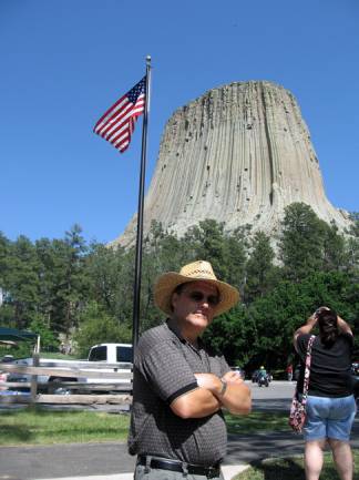
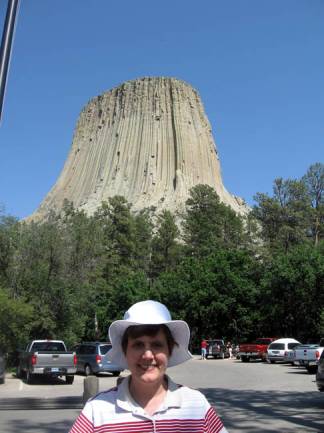
Us
in front of Devil’s Tower
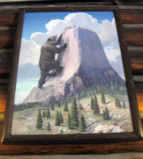
This
is a photograph of the Indian legend about the tower. There seem to be
two
versions of the story, but both involve a group of children, one of
them turns
into a giant bear and chases the others up the tower. The long
indentations in
the stone are the marks of the bear’s claws.
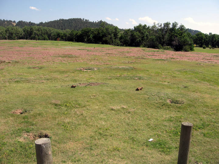
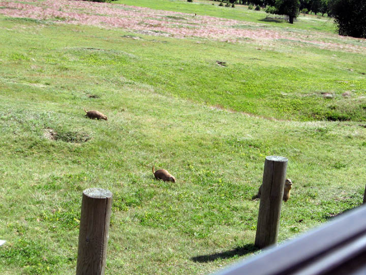
On
the way away from the Tower we saw a group of prairie dogs. They were
so cute.
Even though we were told not to feed any wildlife some people who had
also
stopped to look at them couldn’t resist and fed them as they hurried
over.
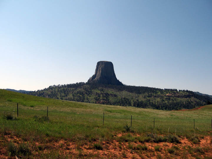
Another
view of Devil’s Tower. We were surprised at how green it was. They’d
had a wet
spring and the green color came from lichen on the stone. We spent the
night in
Hill City, SD. Then it was time for us to go to Mount Rushmore.
Sun,
July 20 Mount Rushmore
National Monument, Crazy Horse Park, Lead City
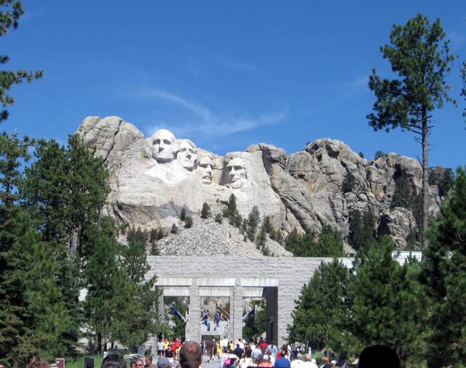
The
visitor’s area at Mount Rushmore was upgraded in 1998. It was very well
done.
Parking was below ground level so nothing interfered with the view of
the
monument.
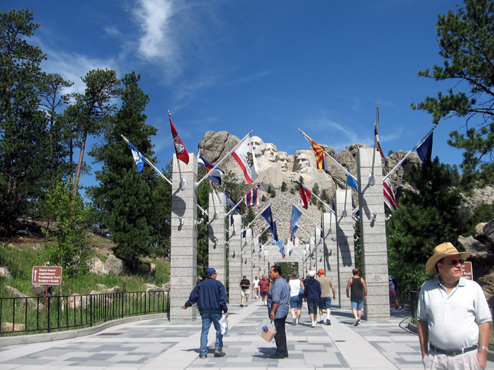
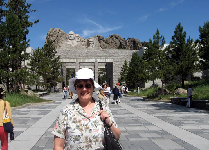
There
is a terrace of flags for all 50 US states and 6 territories and
protectorates.
We’d expected them to be displayed in chronological order for when they
entered
the union, but they were arranged alphabetically.
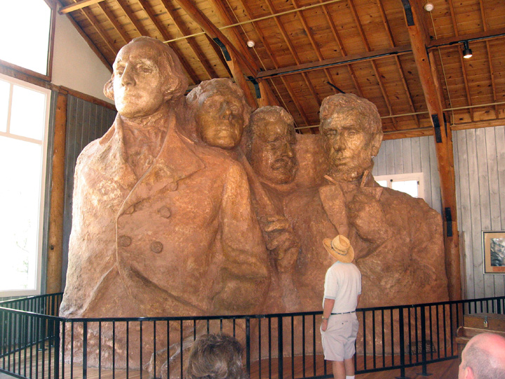
The
sculptor, Gutzon Borglum, had originally planned to have the figures
shown to
the waist, but the stone of the mountain didn’t allow that. The
original idea,
to create something that would bring tourists to South Dakota, was to
have the
heads of Western heroes, but Borglum thought they needed to be more
representative of America as a whole. He decided on George Washington, who
represents the founding of our nation.
Thomas
Jefferson represents the expansion of the nation (Louisiana purchase).
Abe
Lincoln represents the preservation of the union. And finally Teddy
Roosevelt,
a personal friend of Borglum, represents the development and growth of
the
nation (Panama Canal) and the development of the conservation movement
and the
national park system.
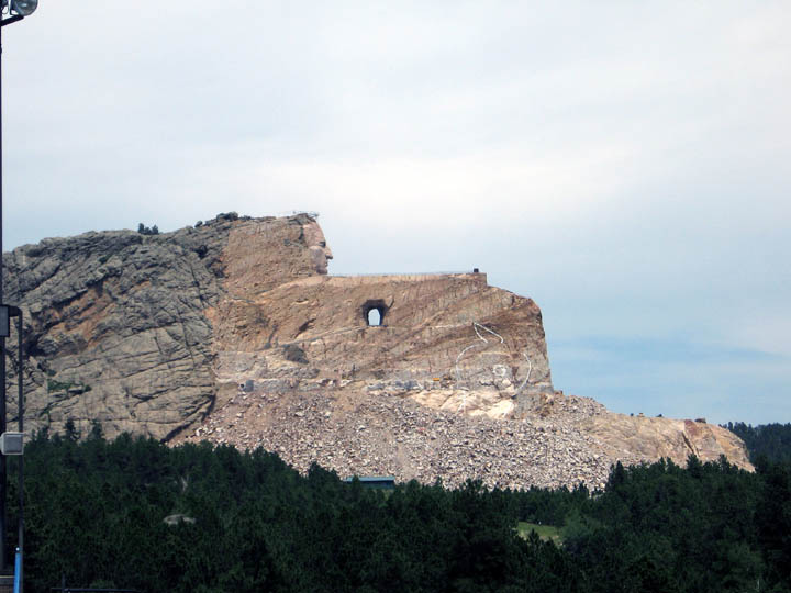
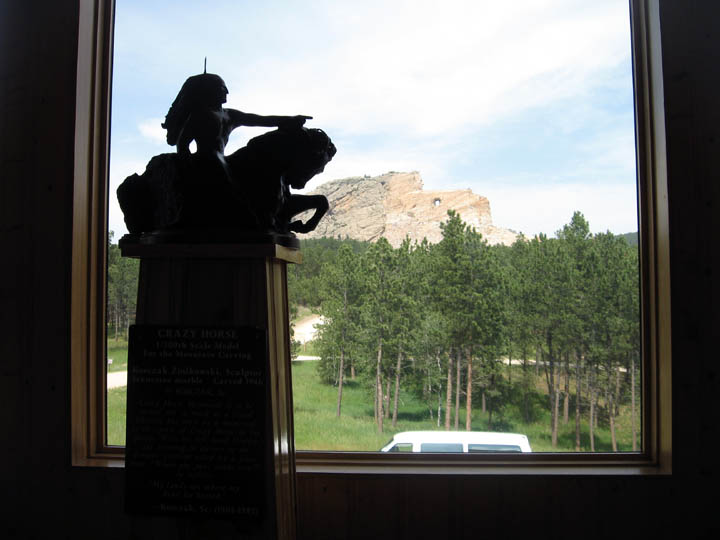
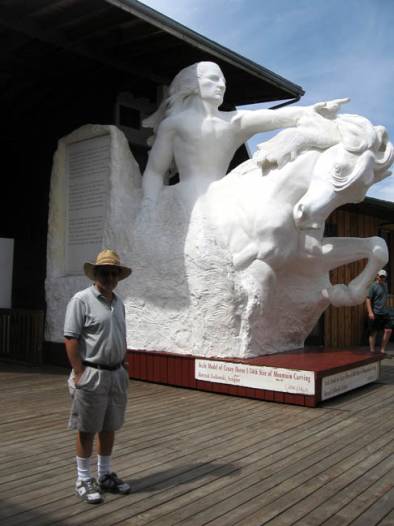
After
Mount Rushmore, an official national monument, we went to see the
privately
funded Crazy Horse memorial. It was begun in 1948 and still has a long
way to
go before completion. The original sculptor and his family after his
death have
said they refuse to accept any government funding and recently turned
down $2
Million. Their Libertarian approach means it will take many, many years
to
finish the carving especially since it’s so much larger than Rushmore.
The
Rushmore heads are 60 feet tall. The Crazy Horse sculpture's final
dimensions
will be 563 feet high and 641 feet wide.
After Crazy Horse, because we were so close, we drove over to Lead, South Dakota, where my grandmother’s cousin lived and where she visited several times. I’d hoped to find the Treweek house on Main Street, but not having an exact address, only an old photo, we didn’t. (I later checked in my family history files and found that in 1908 when my grandparents sent out their wedding announcements, Nicholas and Alberta Treweek were living at 145 N. Mill Street. Wish I’d known that before the trip!)
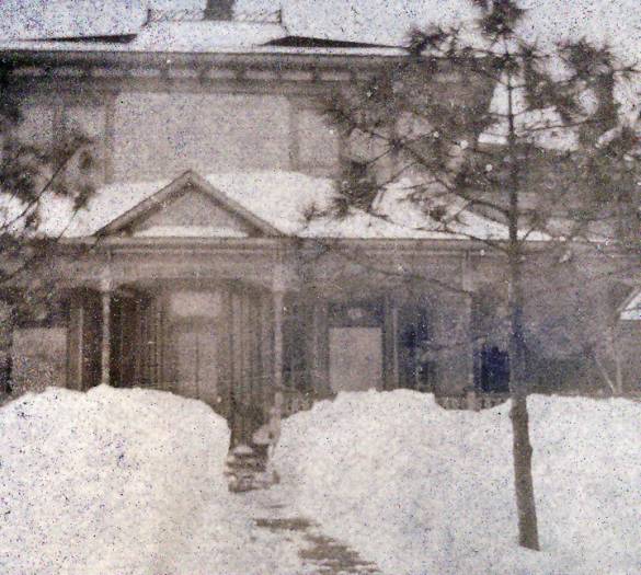
A photo of the Treeweek house in Lead, SD, taken in 1902 by my grandmother. I don’t know if the house still exists. It would have been neat if I could have found it.
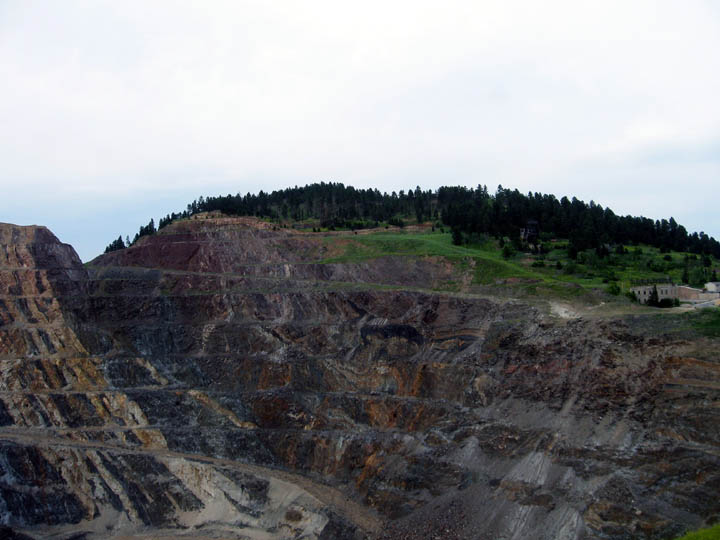
Nick Treweek worked for the Homestake Mine. It began in 1876 and closed in 2002. Before it closed, the Homestake Gold Mine was the oldest, largest and deepest mine in the Western Hemisphere, reaching more than 8000 feet below the town of Lead. We went by the visitor’s center which is next to the historic 1876 Open Cut mining area.
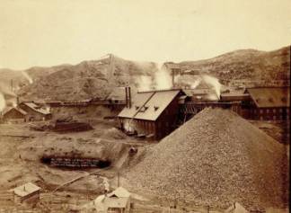
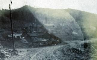
The photo above left is what the mine looked like in 1889 from Wikipedia. The photo on the right was taken by my grandmother in 1902 during one of her visits to Lead, SD to visit her cousin.
After
touring Lead, we drove back to Mount Rushmore to see the evening
program. On
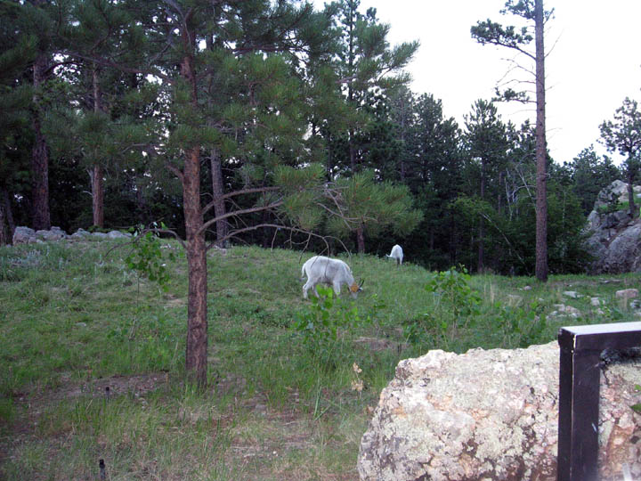
the way in we saw these sheep grazing.
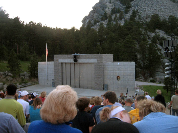
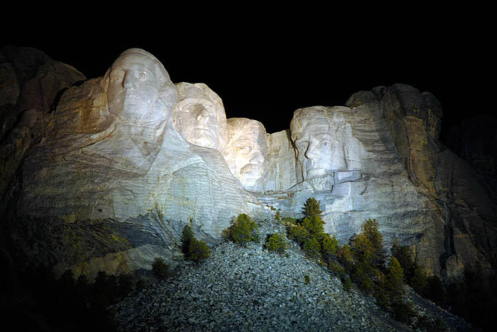
There is a huge outdoor amphitheater at Mount Rushmore. We hadn’t expected it to fill, but it did. After the program of patriotic songs and explanations about how and why the monument was made, the sculpture was lighted. We took a photo, but without a timed exposure, it didn’t turn out as well as one I found on the web.
Mon,
July 21 Badlands National
Park, Wounded Knee, South Dakota
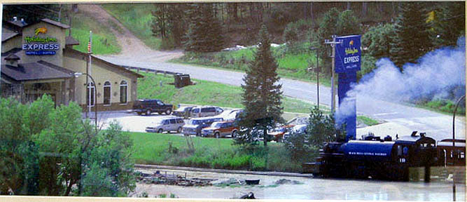
We spent the night in Hill City, South Dakota at a Holiday Inn Express that was next to a vintage 1880 train.

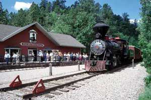
The photos above are from the motel and train websites. The photo below was in the breakfast room at the Holiday Inn. Because we’d missed taking a picture ourselves of the train near the Inn, I asked if there were any copies of the framed one available and was told it had been taken by a photographer who had stayed at the Inn and was the only one they had. They let me take a picture of the picture.
My sister had asked what our car looked like with all our camping gear in it. So I took some photos in the Holiday Inn parking lot before we drove on to our next destinations, the Badlands National Park and Wounded Knee.
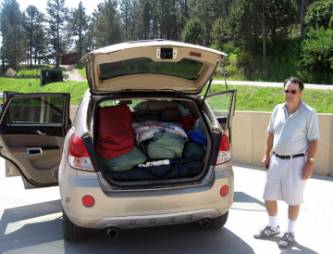
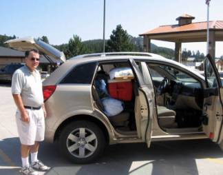
We were lucky to have gotten an SUV, in this case a Saturn Vue. By the end of the trip we could pack and unpack it quickly, but it was still very full! We drove through the Badlands National Park.
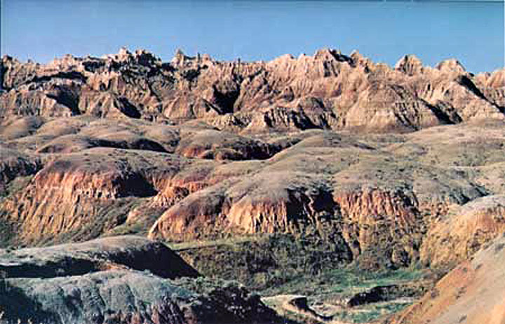
The photo of the Badlands is from the NPS website
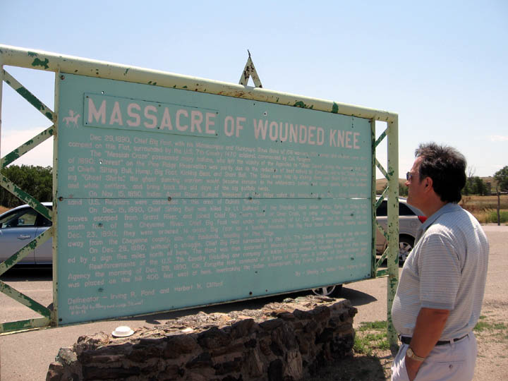
When we moved to AZ, Smoot read the classic book, “Bury My Heart at Wounded Knee” and wanted to see where the massacre took place.
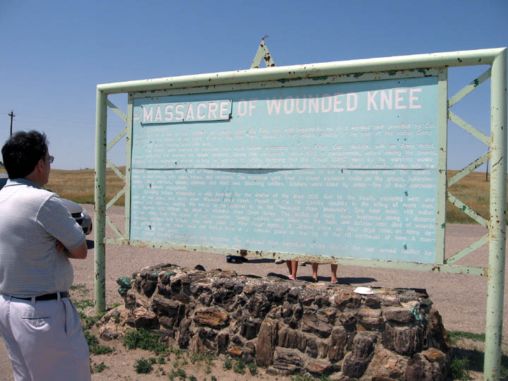
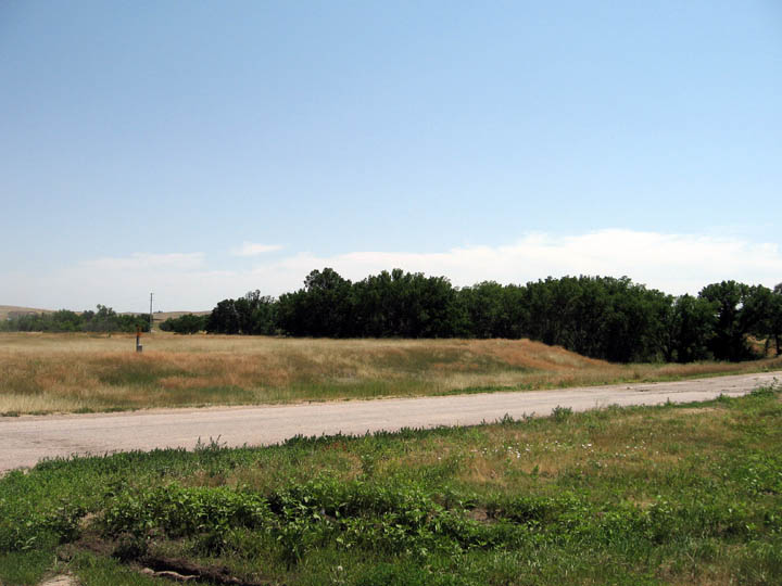
People died at several areas around Wounded Knee. This is near the creek where many Indians took shelter.

We filled the car up at a gas station that had its signs in Lakota first and English second.
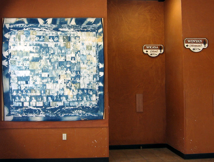
That included the signs on the restrooms. Also displayed was a lovely pictorial quilt.
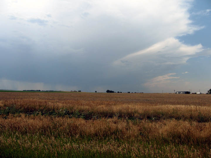
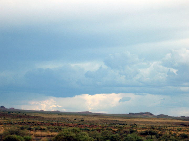
As we drove into Nebraska, we
saw a dramatic storm raking the prairie. We spent
the night in Scottsbluff, NE. We noticed that there was a Scotts Bluff
National
Monument so we thought we’d wander by and see it.
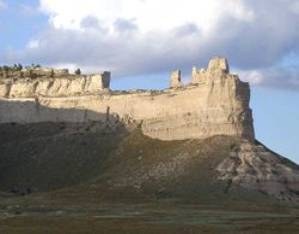
Tues,
July 22 Scotts Bluff
National Monument, NE, Rocky Mountain National Park, CO
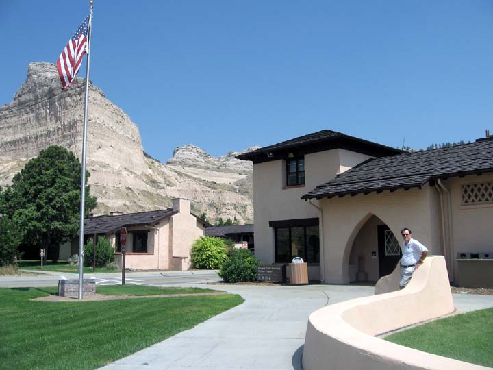
Smoot
in front of the Scotts
Bluff National Monument in
Scottsbluff,
Nebraska.
Scottsbluff
was a major landmark on the Oregon Trail. Like the Nez Perce and Lewis
&
Clark centers, this small monument was a fascinating place with
interesting
exhibits and talks. Smoot spent almost an hour chatting with Jerry, one
of the
rangers, about the Native American experience. Jerry called the whites
who
poured into Indian lands a destructive i”nvasive species!”
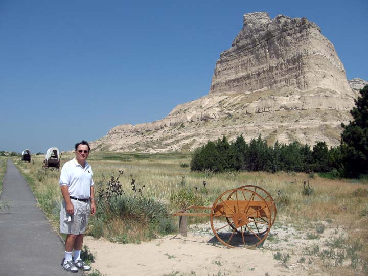
Smoot
by a handcart. Many Mormon pioneers crossed the plains pushing such a
cart.
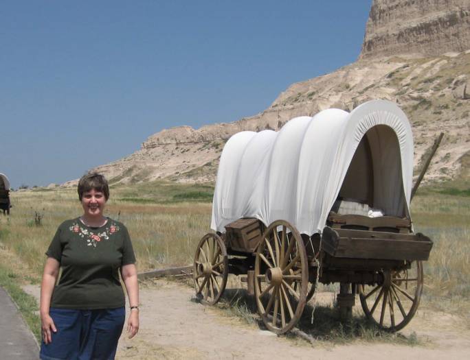
Me
by a covered wagon. They’re trying to duplicate the prairie plants so
we were
told to stay on the path and not trample the vegetation.
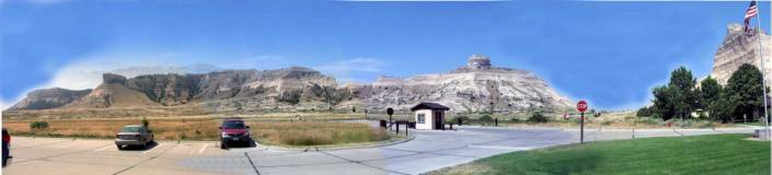
A
panorama of the Scottsbluff area.
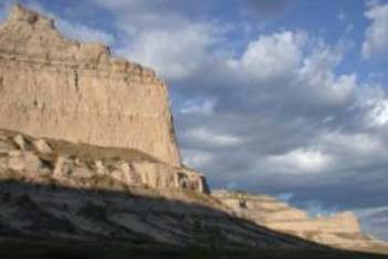
Two
views of Scottsbluff from Wikipedia
Our
next stop was the Rocky Mountain National Park in Colorado.
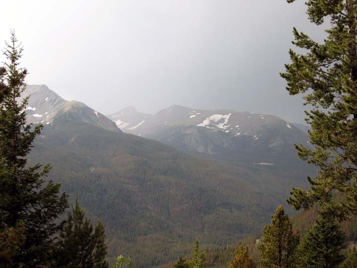
Some
of the Rocky Mountains still had snow on them.
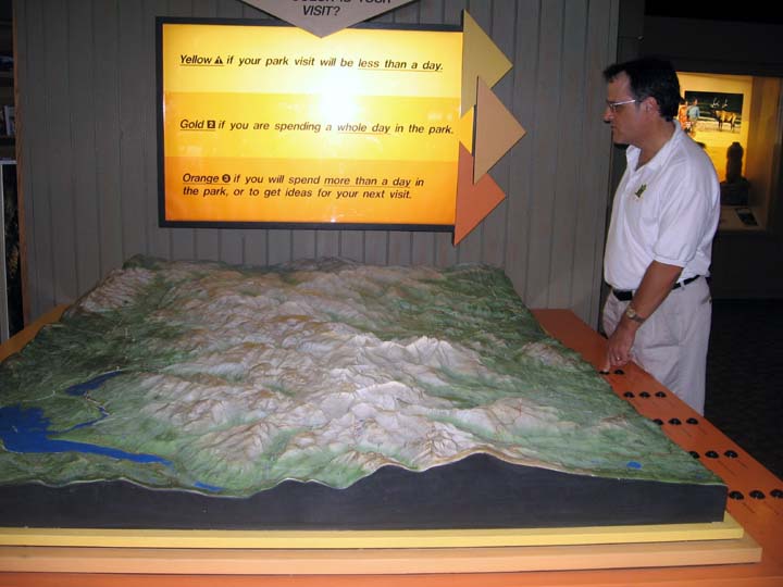
The
Rocky Mountain National Park visitor’s center has an impressive diorama
that
let you light up trails. It’s hard to see, but Smoot was pushing the
button to
light up the drive that we’d just done. We spent the night in Frisco,
Colorado.
Wed,
July 23 Colorado National
Monument, Fruita, CO; Arches National Park, near Moab, UT
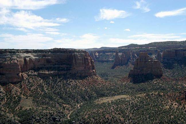
A
view of the Colorado Monument Canyon from Wikipedia. The monument is
near Grand
Junction, Colorado
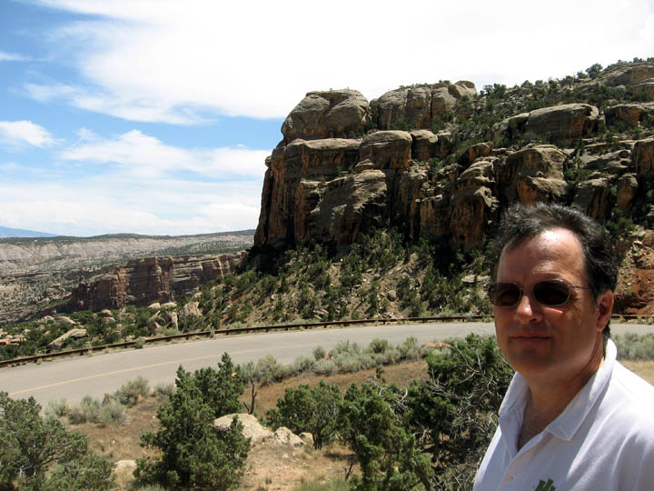
Smoot
in Arches National Park near Moab, Utah
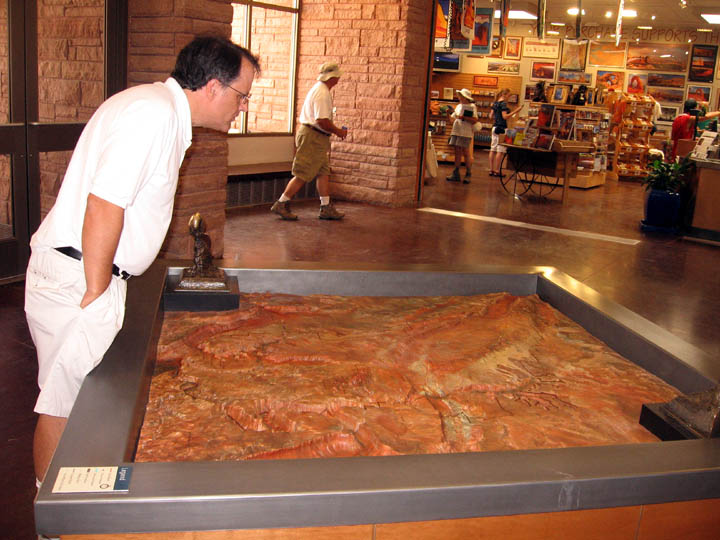
Smoot
pouring over a diorama of the park.
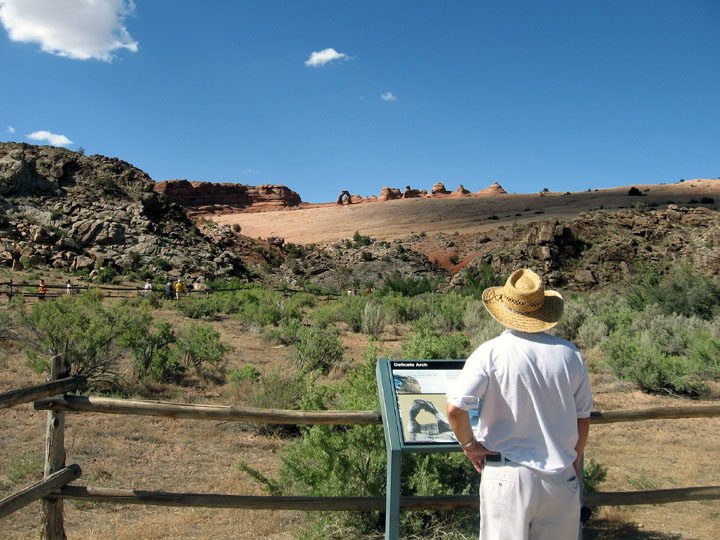
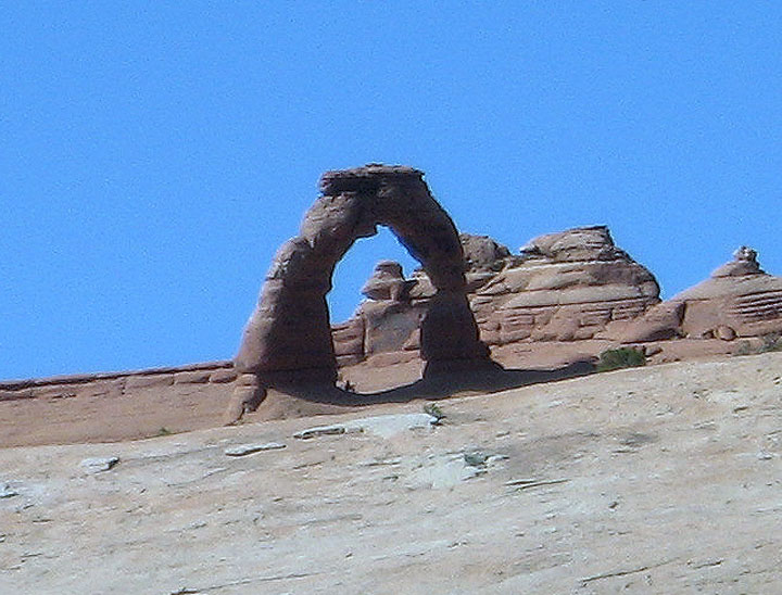
Delicate
Arch in Arches National Park.
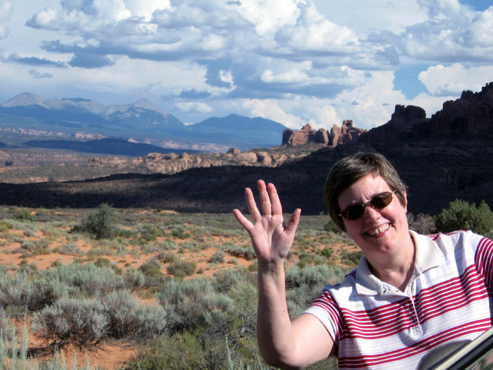
Me
inserting myself into a panorama in Arches National Park.
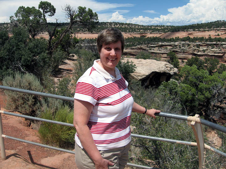
Thurs, July 24 Mesa Verde National Park, Cortez, CO; Four Corners, NM
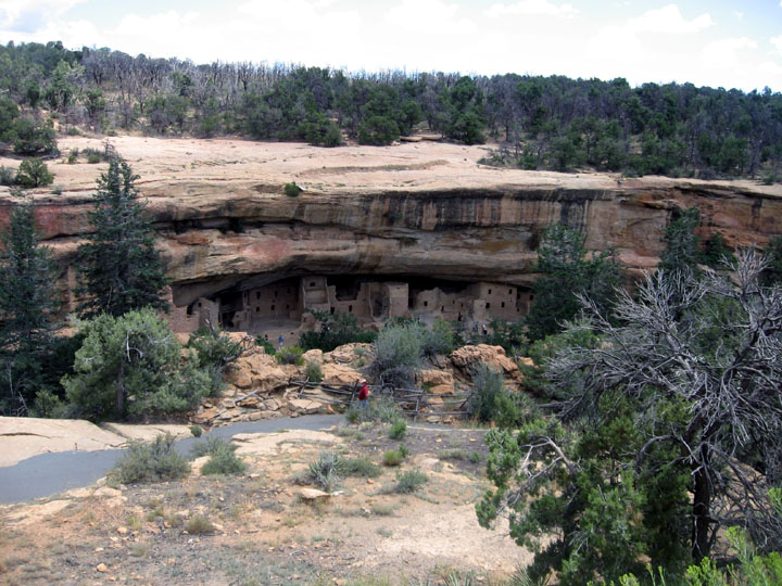
Our next stop was Mesa
Verde
National Park in Cortez, Colorado. We went to Spruce Lodge, one of the
best
preserved sites. It has some amazing ruins of the ancient peoples (one
known as
Anasazi but now as Ancestral Puebloans) who lived there. Some
reconstruction
has been done on the site, but not much.
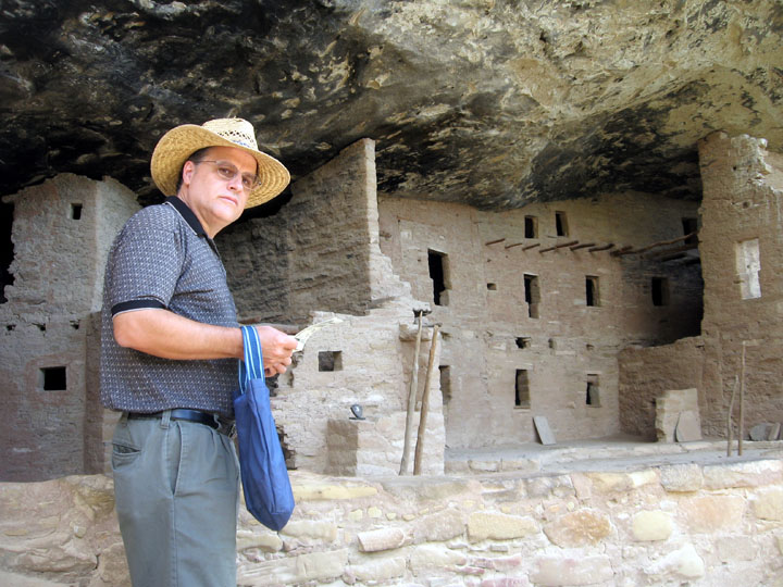
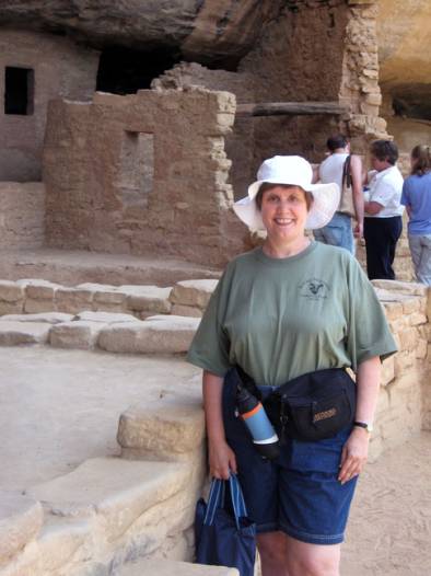
Me wearing my hiking stuff. It was a bit of a
hike down and
back up to the site and was very hot.
In the lower right you can see a hand print made
by one of
the Ancestral Puebloans.
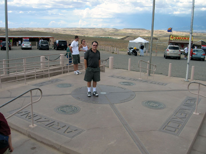
Our next stop was Four Corners, New Mexico,
where four
states converge. We spent the night in Chinle, Arizona in a very nice
Holiday
Inn.
Fri,
July 25 Canyon de Chelly National
Monument; Hubbell Trading Post; Petrified Forest National Park, AZ.
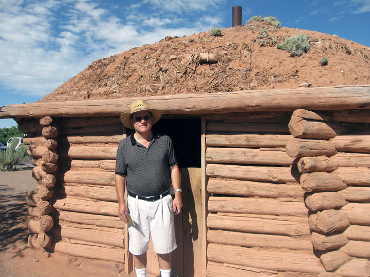
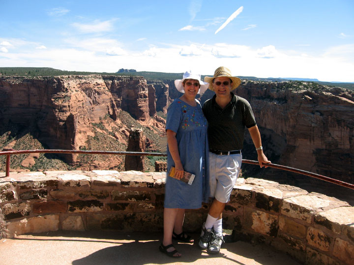
On the last day of our
trip we
drove to the Canyon de Chelly
National Monument on the Navajo Reservation. Above, Smoot in front of a
hogan
at the visitor’s center.
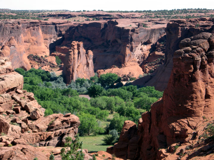
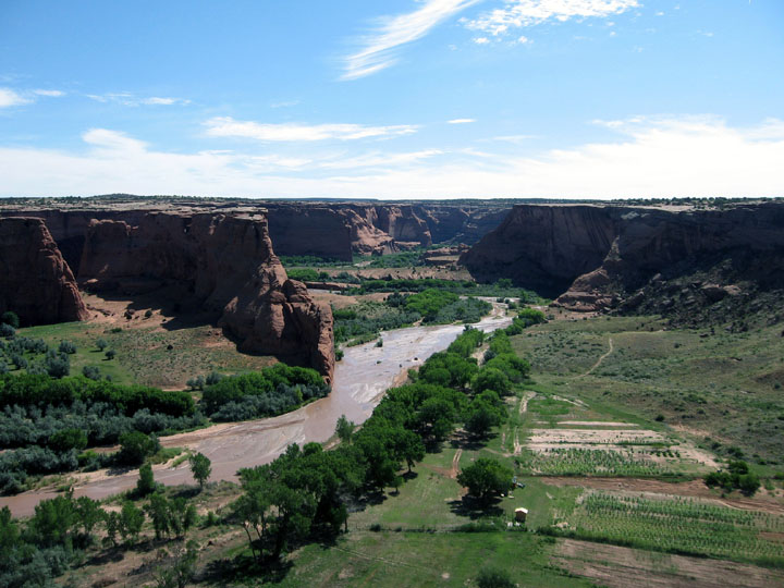
Some of the beautiful scenery in
Canyon de
Chelly. Navajos still live and farm in the area.
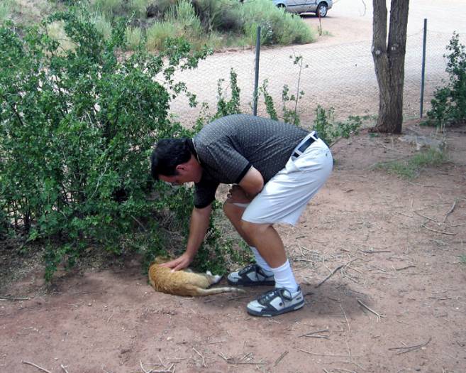
On the
drive from
Canyon de Chelly to the Petrified Forest we saw a sign for the Hubbell
Trading
Post National Historic Site and decided to stop. The photo above is of
Smoot
with the Visitor’s Center cat, Chester the Cat, Esq!
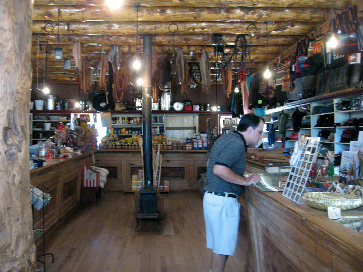
Smoot in what is called the Bullpen at the
Hubbell Trading
Post
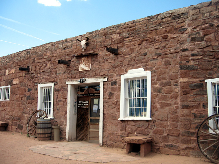
John Lorenzo Hubbell purchased a trading post here in 1878, ten years after Navajos returned to their homeland from their terrible exile at Bosque Redondo, Ft. Sumner, New Mexico. Hubbell family members operated this trading post until it was sold to the National Park Service in 1965. The trading post store is still active.
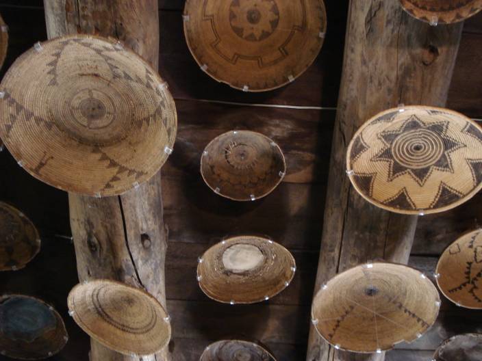
In one of the rooms the original owners had attached their collection of beautiful and very old baskets on the ceiling. A nice way to display them but many of the tribal elders refuse to enter the room because the baskets are upside down, not a lucky sign.
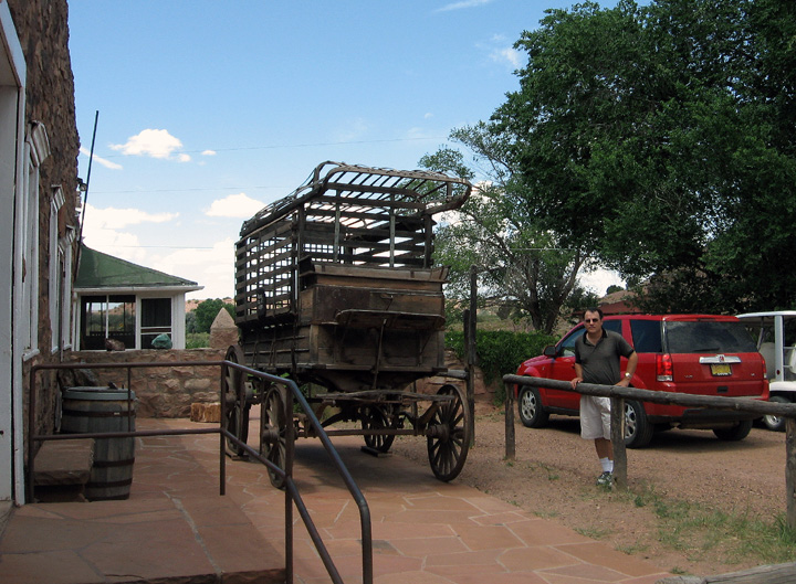
Smoot standing between two types of transportation – old and new.
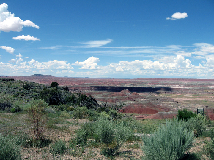
Our final stop was the Painted Desert and Petrified Forest
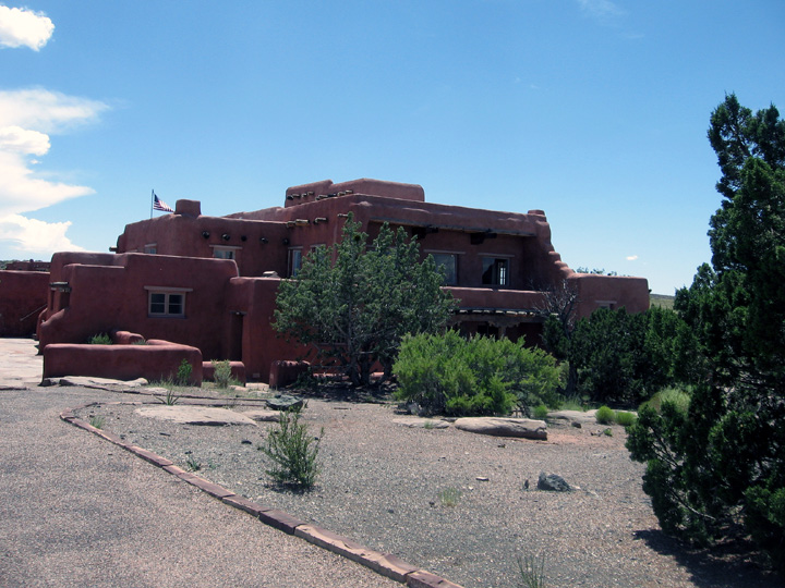
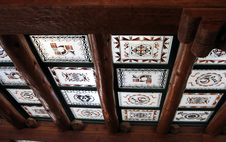
We went inside the old Inn, now a museum. It had a beautiful glass panel ceiling that had recently been restored.
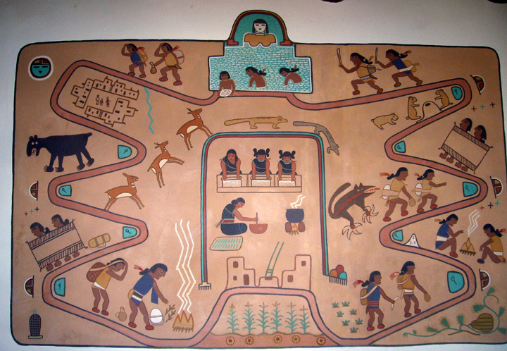
It also had some lovely art.
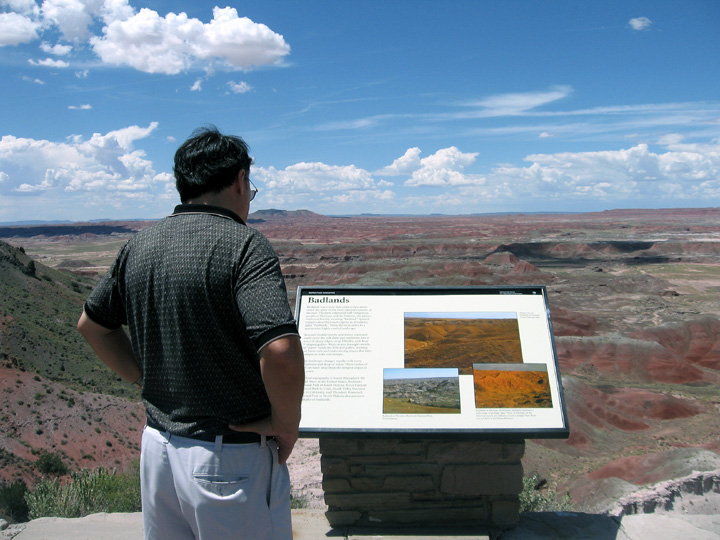
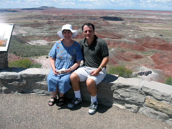
A couple of very nice gay men from the Netherlands took our photo in front of the Painted Desert.
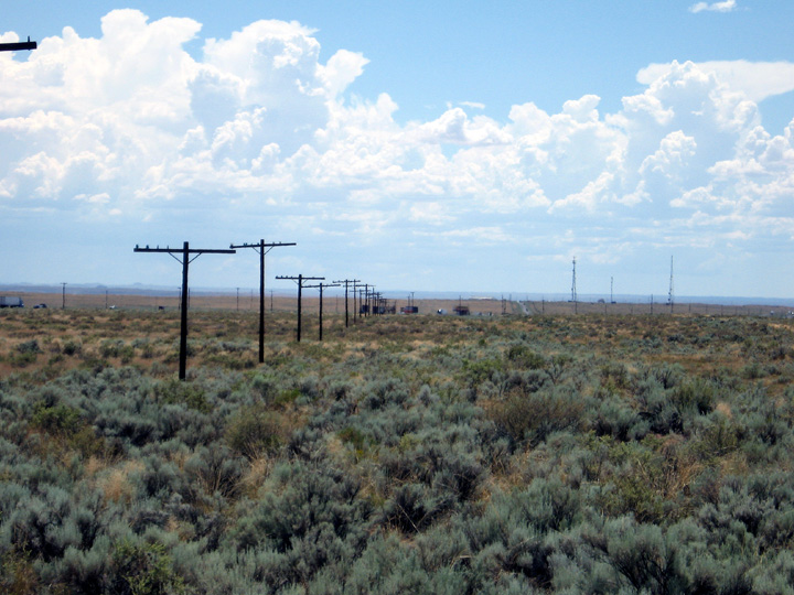
On the way from the Painted Desert, we crossed an area that used to be part of Route 66, now just a row of empty phone poles.
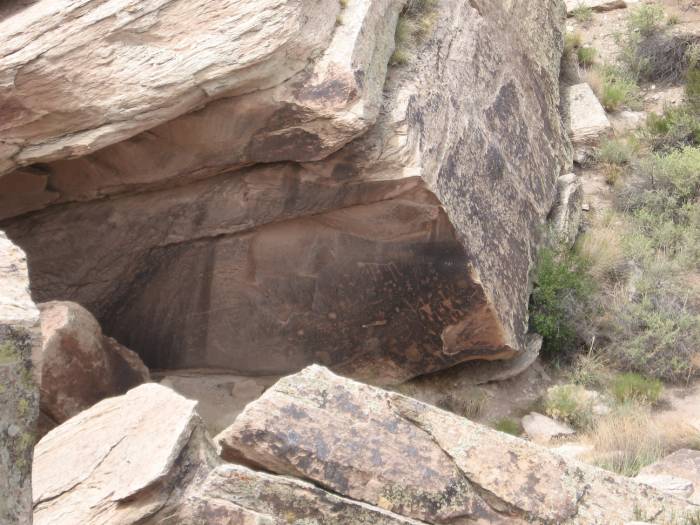
We stopped to see some ancient petroglyphs.
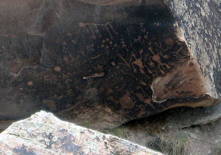
A close-up of the glyphs
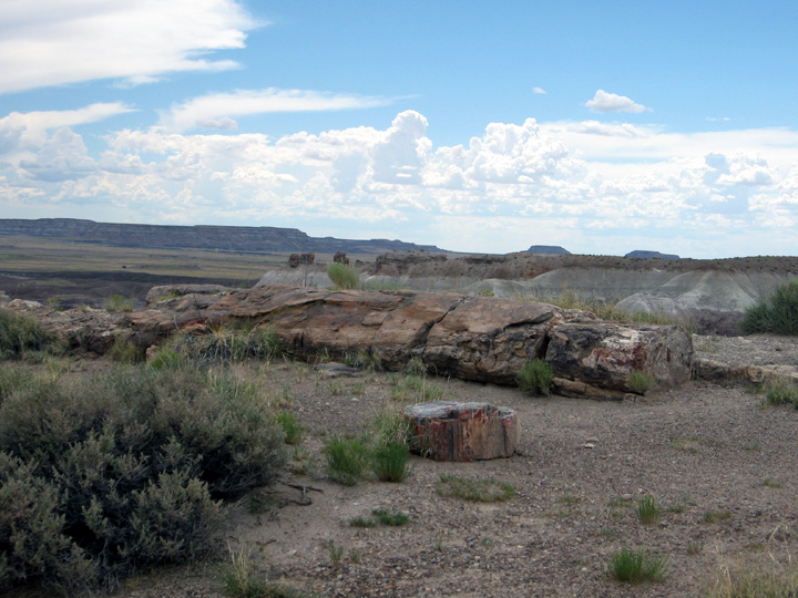
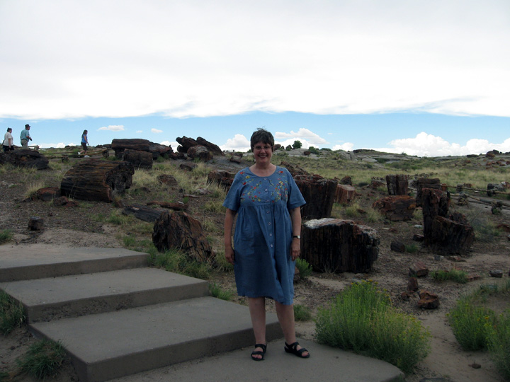
A petrified tree in Petrified Forest
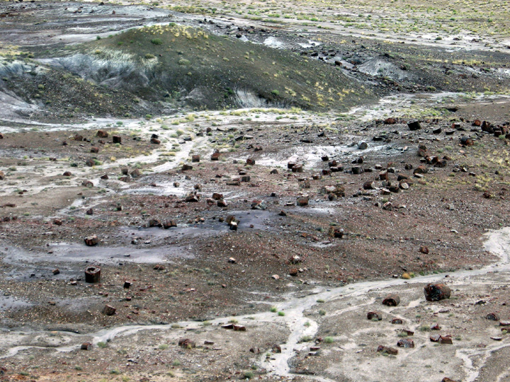
More petrified wood. At the turn of the last century so many people were hauling off the wood to sell, the area was turned into a park to preserve what’s left. People even used dynamite to blow up the logs to get to the crystals inside them!
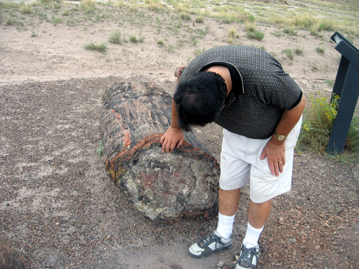
Smoot checking out a log.
On the way home we played tag with a big storm system.
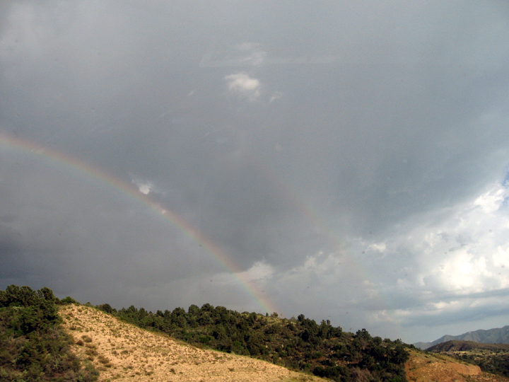
We avoided most of the rain, but saw this lovely double rainbow.
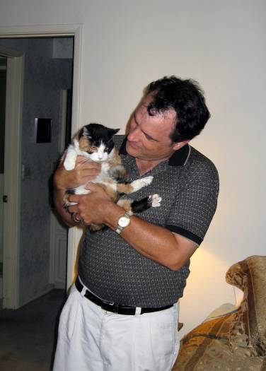
Then we got back home and checked in with our critters. Pico was her usual low-key self.
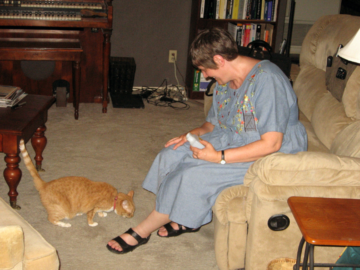
I had to bribe Annie with a treat to get her to come over and let me pet her!
We ended up touring 12 states, 14 national parks, 6 national monuments, 2 historic interpretive centers, 4 cities (Lake Havasu, AZ; Port Townsend, WA; Butte, MT; Lead, SD) 1 state park, 2 historic sites, 1 dam and 1 mini family reunion in Lacey, WA. And we drove 6,411 miles! We saw a lot of beautiful and interesting places, but it was a bit of a whirlwind. Should we do this again, we’ll try to stay in places a bit longer than one night!